Black Creek Marsh Wildlife Management Area
Download a High Resolution JPEG Image of the Black Creek Marsh Wildlife Management Area or an Adobe Acrobat Printable PDF of the Black Creek Marsh Wildlife Management Area.


Bookmark my free Interactive GPS Map for your phone:
https://andyarthur.org/ny
... shows your location as a blue dot in relationship to campsites, trails, state land. This online map requires cell service, won't work in remote country, so also bring a paper map.
Free Download of New & Historical USGS 1:24k Topograpic Maps
Interactive maps with backcountry and roadside camping: New York, Pennsylvania, West Virginia & Vermont. List of NYS DEC Lean-Tos and Firetowers.
Google Spreadsheet with Roadside, Primitive and Pay Campsites
More about Black Creek Marsh Wildlife Management Area...
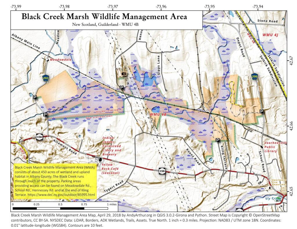
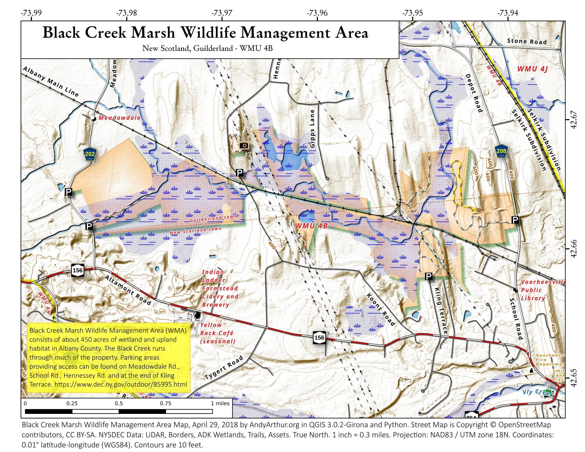
lack Creek Marsh Wildlife Management Area (WMA) consists of about 450 acres of wetland and upland habitat in Albany County. The first purchases here occurred in the 1960's. It is located in the Towns of Guilderland and New Scotland, and some portions are in the Village of Voorheesville. The Black Creek runs through much of the property. The WMA is also bisected by an active railroad line. Parking areas providing access can be found on Meadowdale Rd., School Rd., Hennessey Rd. and at the end of Kling Terrace. This parcel of public land affords multiple uses for outdoor recreation including hunting, trapping, limited angling, birding, and hiking.


No Comments
Andy. You are wonderful!