Local Names for Brooks, Creeks, Kills, Rivers, Runs and Streams
Download a High Resolution JPEG Image of the Local Names for Brooks, Creeks, Kills, Rivers, Runs and Streams or an Adobe Acrobat Printable PDF of the Local Names for Brooks, Creeks, Kills, Rivers, Runs and Streams.
About Map: Local Names for Brooks, Creeks, Kills, Rivers, Runs and Streams ....
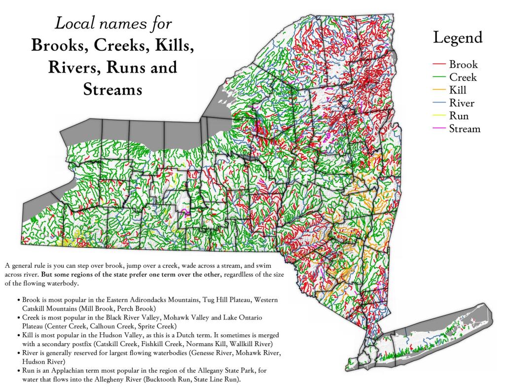
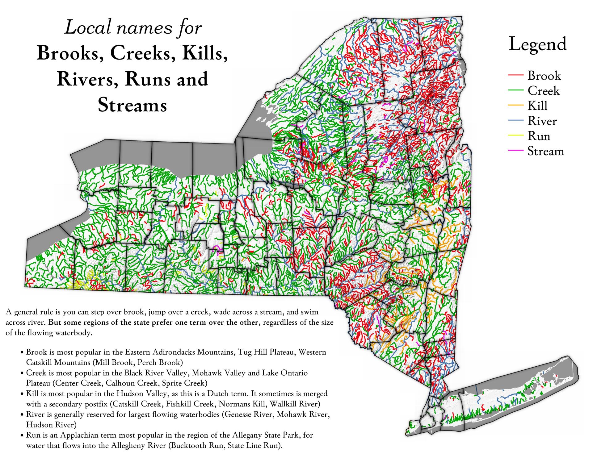
A general rule is you can step over brook, jump over a creek, wade across a stream, and swim across a river. But some regions of the state prefer one term over the other, regardless of the size of the waterbody.


Bookmark my free Interactive GPS Map for your phone:
https://andyarthur.org/ny
... shows your location as a blue dot in relationship to campsites, trails, state land. This online map requires cell service, won't work in remote country, so also bring a paper map.
Free Download of New & Historical USGS 1:24k Topograpic Maps
Interactive maps with backcountry and roadside camping: New York, Pennsylvania, West Virginia & Vermont. List of NYS DEC Lean-Tos and Firetowers.
Google Spreadsheet with Roadside, Primitive and Pay Campsites
More about Waterbodies...


