Hays Brook Horse Trails

Download a High Resolution JPEG Image of the Hays Brook Horse Trails or an Adobe Acrobat Printable PDF of the Hays Brook Horse Trails.
About Map: Hays Brook Horse Trails ....
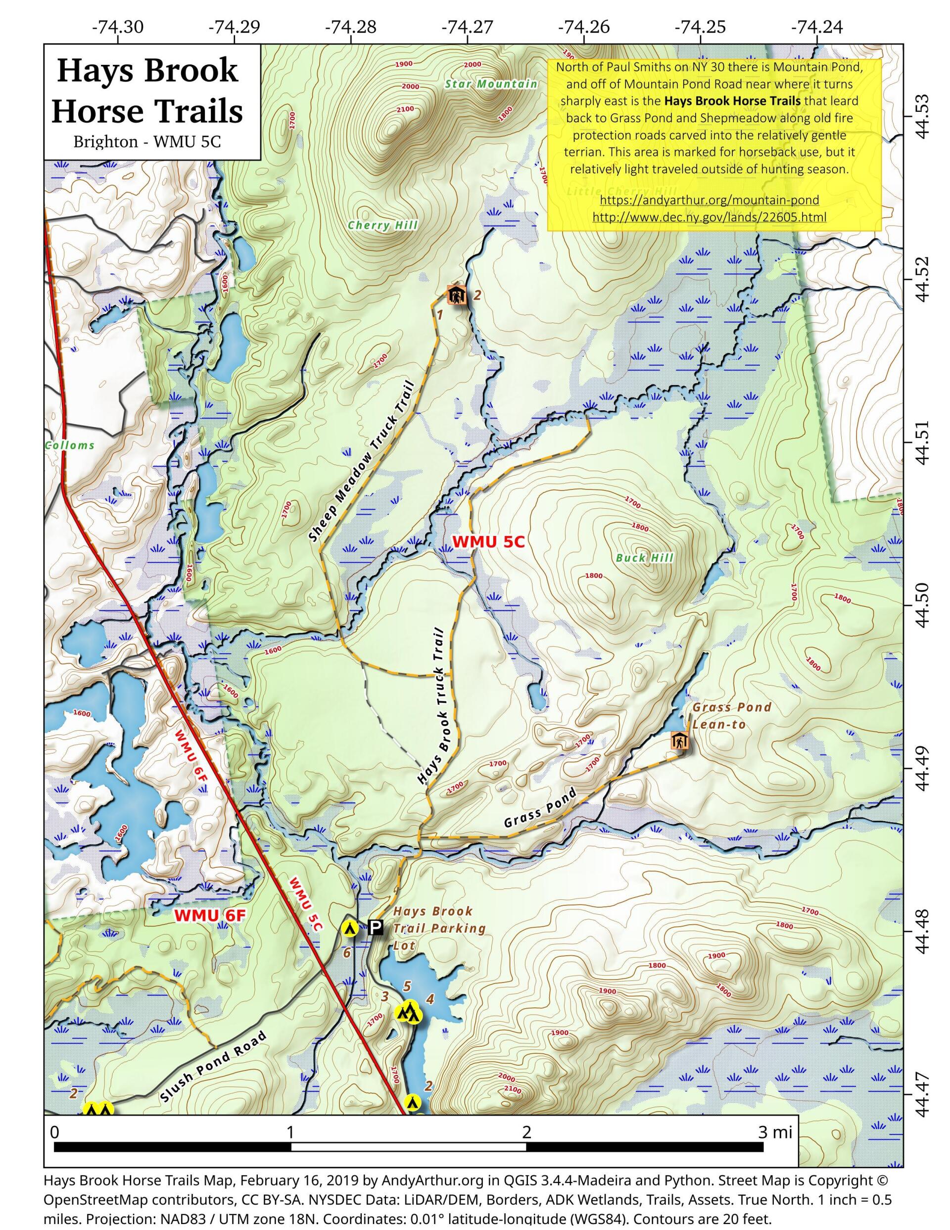
North of Mountain Pond in Paul Smiths is an old routing of NY 30 and several old fire protection roads that are used today for hiking, horseback riding, and accessing backcountry hunting locations. Known as the Hays Brook Horse Trails, there is a small parking area along Mountain Pond Road (Old Route 30), along with a falling apart wooden sign indicating the trail head.


Bookmark my free Interactive GPS Map for your phone:
https://andyarthur.org/ny
... shows your location as a blue dot in relationship to campsites, trails, state land. This online map requires cell service, won't work in remote country, so also bring a paper map.
Free Download of New & Historical USGS 1:24k Topograpic Maps
Interactive maps with backcountry and roadside camping: New York, Pennsylvania, West Virginia & Vermont. List of NYS DEC Lean-Tos and Firetowers.
Google Spreadsheet with Roadside, Primitive and Pay Campsites
More about Mountain Pond...
Mountain Pond is a small, narrow lake, located along Old Route 30, just 2 miles north of Paul Smiths. Offers 6-roadside camping spots, along with a secluded, lesser used pond, near Barnum Pond and Osgood Pond.
Download the PDF Map Pack with All Maps from Mountain Pond.


No Comments
Wondering if fishing at Mountain Pond is strictly catch and release, since Mountain Pond is home to a heritage strain of brook trout?
Correct for trout. https://www.dec.ny.gov/outdoor/31444.html