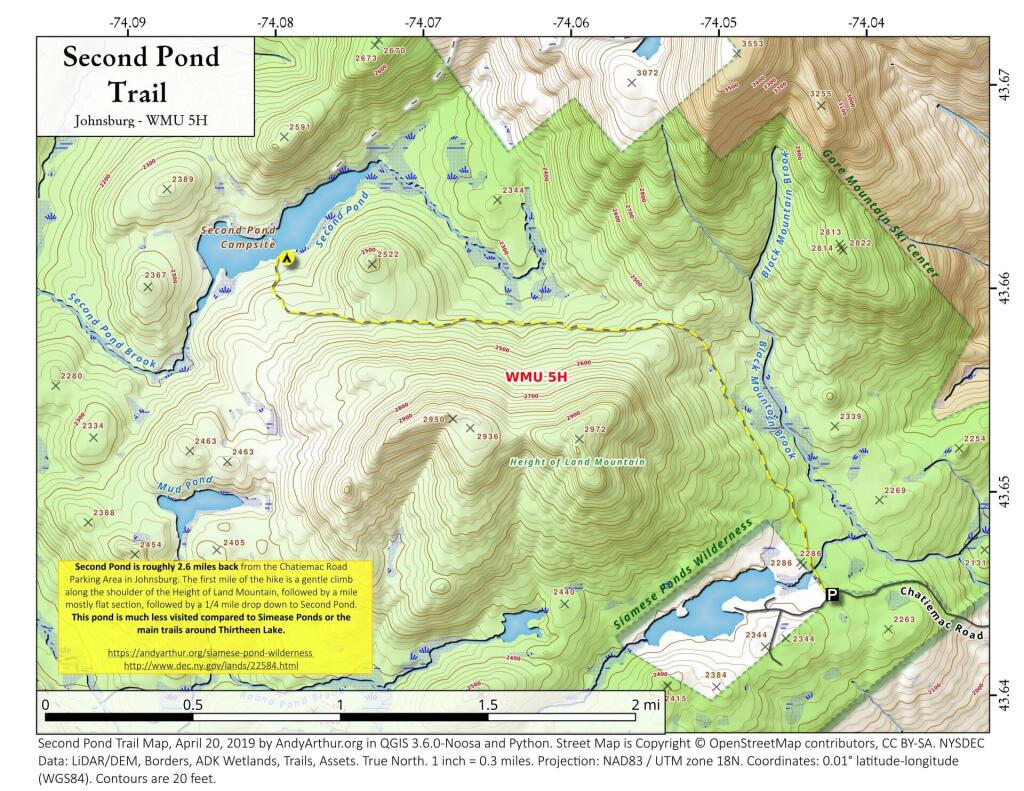
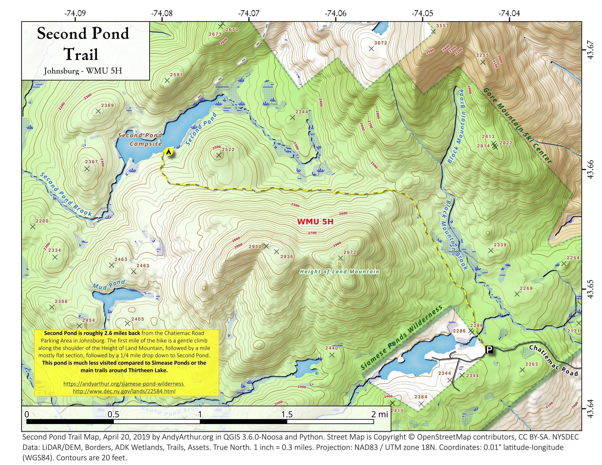
Second Pond Trail
Download a High Resolution JPEG Image of the Second Pond Trail or an Adobe Acrobat Printable PDF of the Second Pond Trail.
About Map: Second Pond Trail ....
The Second Pond Trail is a 2.5 mile hike back from Chatiemac Lake Road in Bakers Mills. While the trail can be muddy, especially in the spring, this remote lake is good for solitude and brookies.


Bookmark my free Interactive GPS Map for your phone:
https://andyarthur.org/ny
... shows your location as a blue dot in relationship to campsites, trails, state land. This online map requires cell service, won't work in remote country, so also bring a paper map.
Free Download of New & Historical USGS 1:24k Topograpic Maps
Interactive maps with backcountry and roadside camping: New York, Pennsylvania, West Virginia & Vermont. List of NYS DEC Lean-Tos and Firetowers.
Google Spreadsheet with Roadside, Primitive and Pay Campsites
More about Siamese Pond Wilderness...
The Siamese Ponds Wilderness (SPW) is one of the larger Wilderness designated areas in the Adirondack Park. It extends some 24 miles north and south and 18 miles east and west and contains approximately 46,138.43 hectares (114,010.1 acres) of Forest Preserve lands. Associated with the SPW are the Dug Mountain, Forks Mountain and Chatiemac Primitive Areas. During the early part of the nineteenth century, logging became an important industry in the region, and most of the Wilderness was heavily cut over. Devastating fires at the turn of the century continued to significantly impact this natural resource.
Today, however, the area shows little evidence of these past impacts and has become known for its natural beauty. Popular points of interest include the Siamese Ponds that gave the area its name, Puffer Pond, Puffer Mountain, Chimney Mountain, Auger Falls, and Thirteenth Lake.
http://www.dec.ny.gov/lands/22596.html
http://www.cnyhiking.com/SiamesePondsWilderness.htm
Download the PDF Map Pack with All Maps from Siamese Pond Wilderness.


