Deep Pond Trail
Download a High Resolution JPEG Image of the Deep Pond Trail or an Adobe Acrobat Printable PDF of the Deep Pond Trail.
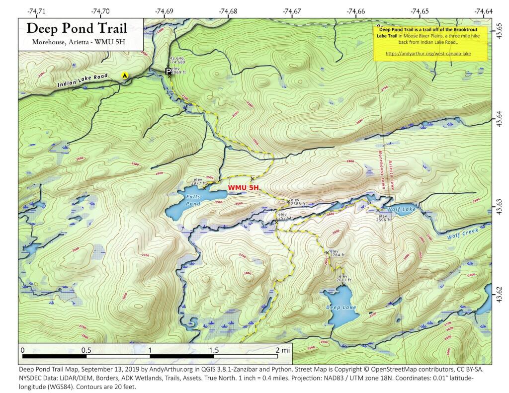
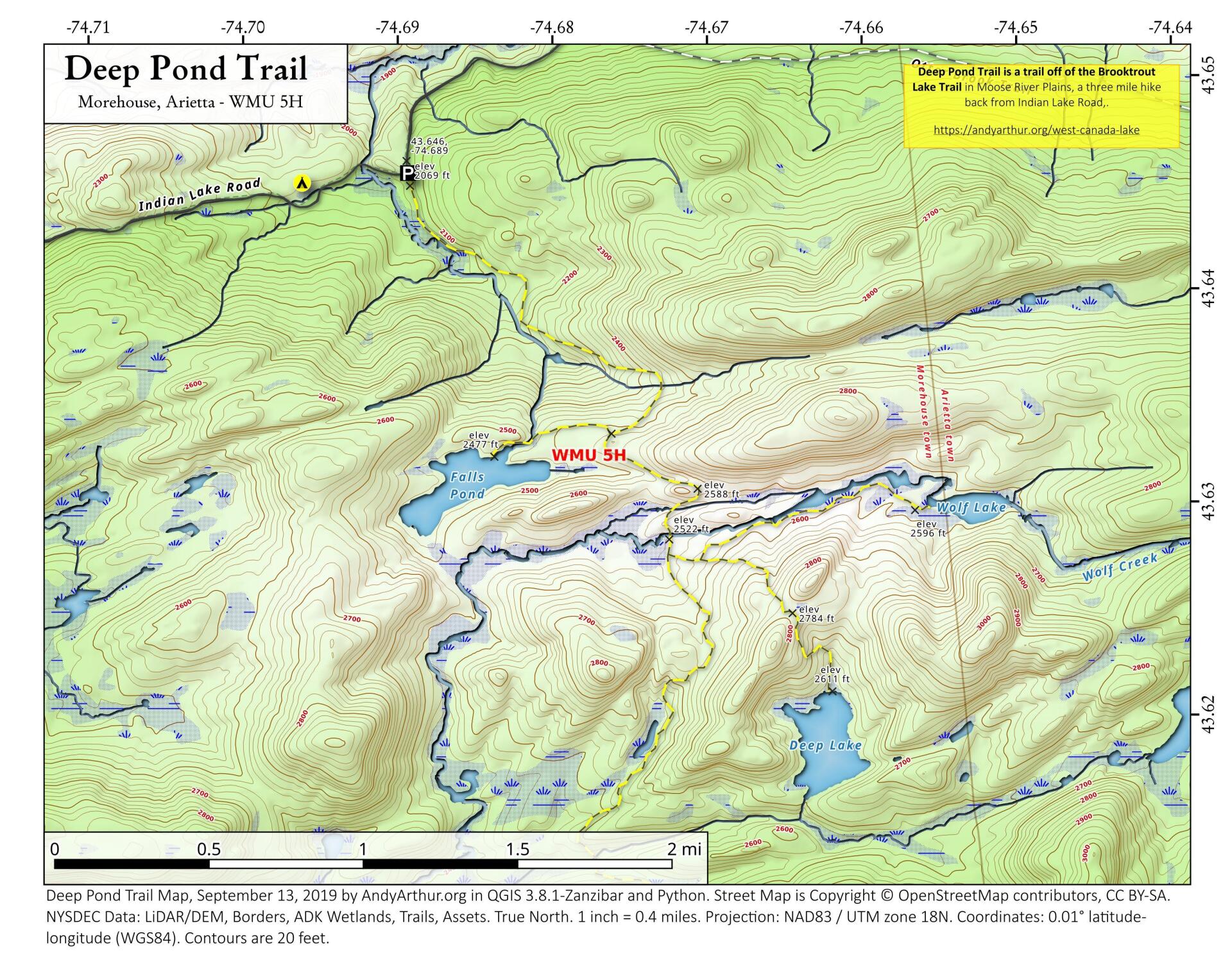
About Map: Deep Pond Trail ....
Deep Pond Trail is located off of the Brooktrout Lake Trail in Moose River Plainss (technically West Canada Lake Wilderness), and is a three mile hike back from Idnain Lake Road.


Bookmark my free Interactive GPS Map for your phone:
https://andyarthur.org/ny
... shows your location as a blue dot in relationship to campsites, trails, state land. This online map requires cell service, won't work in remote country, so also bring a paper map.
Free Download of New & Historical USGS 1:24k Topograpic Maps
Interactive maps with backcountry and roadside camping: New York, Pennsylvania, West Virginia & Vermont. List of NYS DEC Lean-Tos and Firetowers.
Google Spreadsheet with Roadside, Primitive and Pay Campsites
More about West Canada Lake Wilderness...
The West Canada Lake Wilderness Area is an Adirondack Park Forest Preserve management unit in the town of Ohio in Herkimer County and the towns of Morehouse, Arietta, Lake Pleasant and Indian Lake in Hamilton County. It is bounded on the north by the Moose River Plains area and private lands in the vicinity of Little Moose Lake, Squaw Brook, Snowy Mountain and Squaw Mountain; on the east by NY 30, lands of International Paper and the Spruce Lake-Piseco Lake trail; on the south by private lands north of NY 8, the South Branch of West Canada Creek and an access road to private lands; on the west by West Canada Creek and private lands east of Honnedaga Lake.
The area contains 168 bodies of water covering 2,400 acres (9.6 km2), 78.3 miles (126 km) of foot trails, and 11 lean-tos. The 133-mile Northville-Placid Trail traverses it.
Download the PDF Map Pack with All Maps from West Canada Lake Wilderness.


