R. Milton Hick Memorial State Forest
Download a High Resolution JPEG Image of the R. Milton Hick Memorial State Forest or an Adobe Acrobat Printable PDF of the R. Milton Hick Memorial State Forest.
About Map: R. Milton Hick Memorial State Forest ....
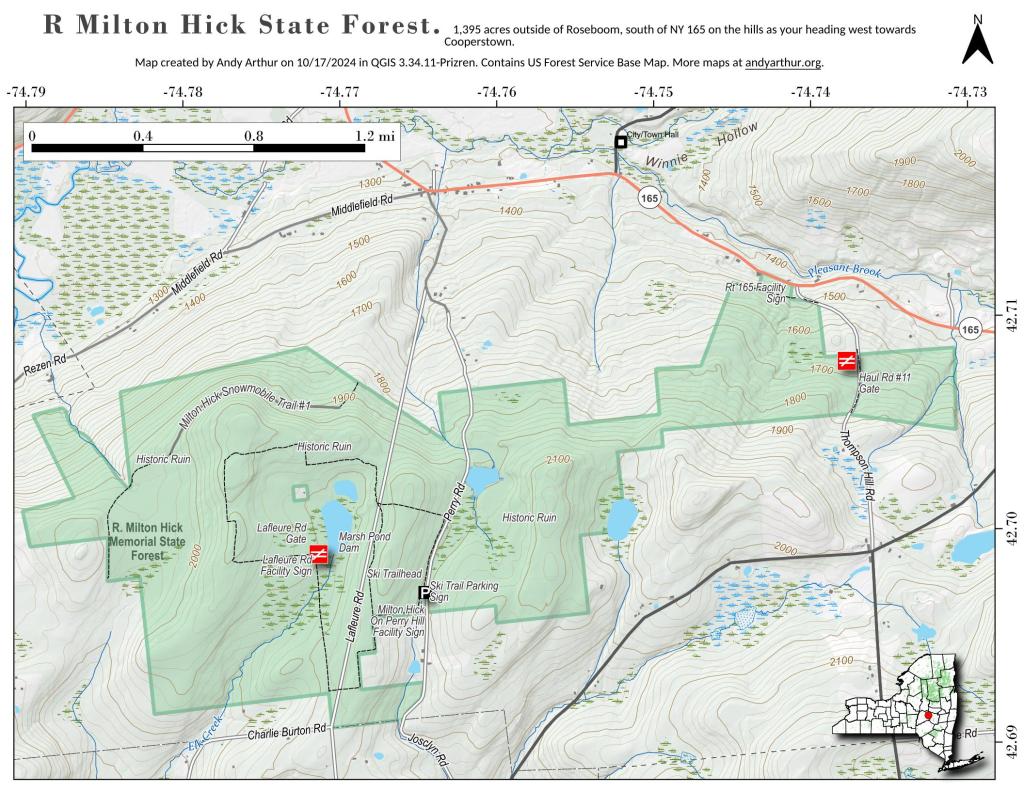
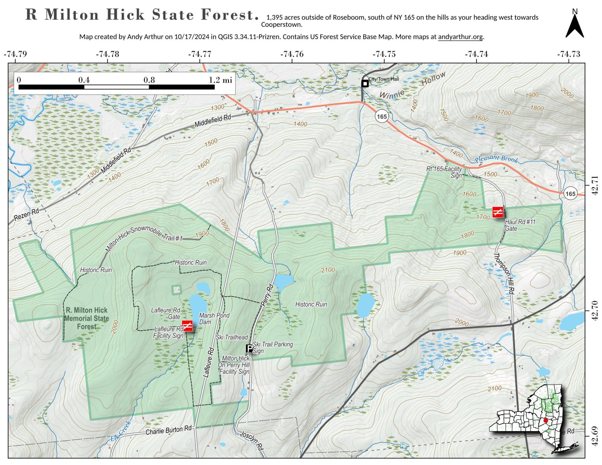
Just to the east of Roseboom is the R. Milton Hick Memorial State Forest, a 1,295 acre forest on the hill to south near where NY 165 turns sharply north as it approaches Roseboom. The state forest is largely undeveloped except for a skil trail that runs from Perry Hill Raod to La Fluere Road.
https://andyarthur.org/decatur-state-forest
http://www.dec.ny.gov/lands/102494.html


Bookmark my free Interactive GPS Map for your phone:
https://andyarthur.org/ny
... shows your location as a blue dot in relationship to campsites, trails, state land. This online map requires cell service, won't work in remote country, so also bring a paper map.
Free Download of New & Historical USGS 1:24k Topograpic Maps
Interactive maps with backcountry and roadside camping: New York, Pennsylvania, West Virginia & Vermont. List of NYS DEC Lean-Tos and Firetowers.
Google Spreadsheet with Roadside, Primitive and Pay Campsites
More about Schoharie County...
Schoharie County is a county located in the U.S. state of New York. As of the 2010 census, the population was 32,749. The county seat is Schoharie.
A primarily rural county known for the fertile Schoharie Valley, it is also home to many state forests, including Burnt-Rossman State Forest.
http://en.wikipedia.org/wiki/Schoharie_County,_New_York
Download the PDF Map Pack with All Maps from Schoharie County.


