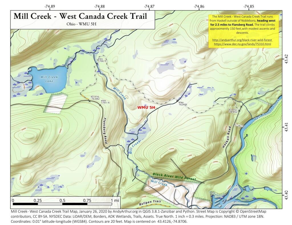
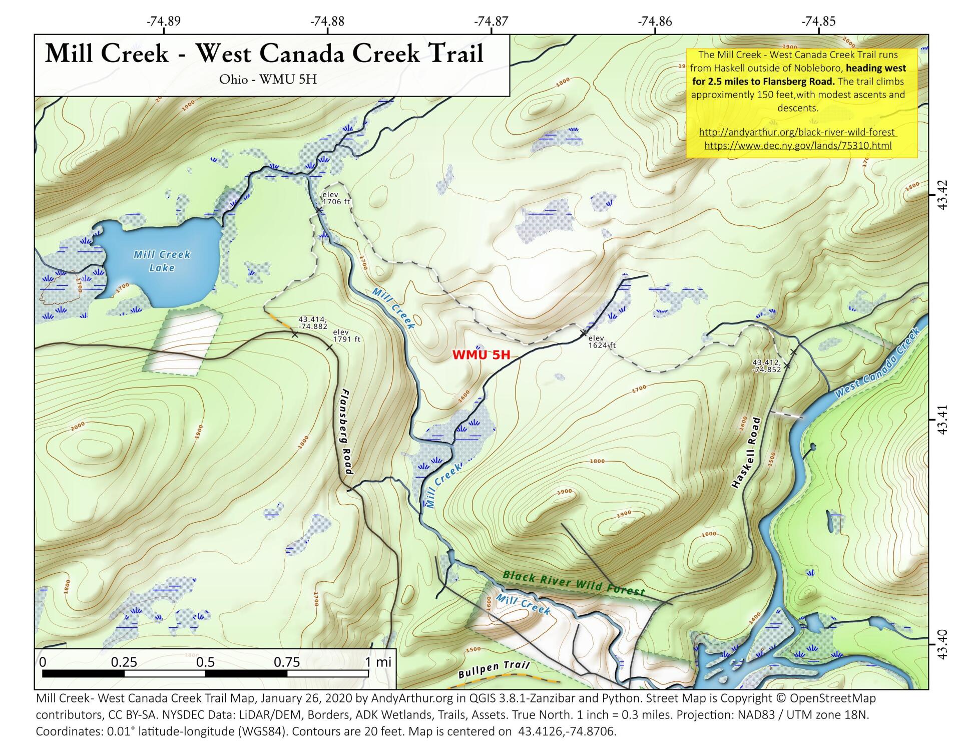
Mill Creek – West Canada Creek Trail
Download a High Resolution JPEG Image of the Mill Creek - West Canada Creek Trail or an Adobe Acrobat Printable PDF of the Mill Creek - West Canada Creek Trail.
About Map: Mill Creek - West Canada Creek Trail ....
The Mill Creek - West Canada Creek Trail runs from Haskell outside of Nobleboro, heading west for 2.5 miles to Flansberg Road. The trail climbs approximately 150 feet,with modest ascents and descents.
http://andyarthur.org/black-river-wild-forest
https://www.dec.ny.gov/lands/75310.html


Bookmark my free Interactive GPS Map for your phone:
https://andyarthur.org/ny
... shows your location as a blue dot in relationship to campsites, trails, state land. This online map requires cell service, won't work in remote country, so also bring a paper map.
Free Download of New & Historical USGS 1:24k Topograpic Maps
Interactive maps with backcountry and roadside camping: New York, Pennsylvania, West Virginia & Vermont. List of NYS DEC Lean-Tos and Firetowers.
Google Spreadsheet with Roadside, Primitive and Pay Campsites
More about Black River Wild Forest...
Download the PDF Map Pack with All Maps from Black River Wild Forest.


