Bass Lake Trail
Download a High Resolution JPEG Image of the Bass Lake Trail or an Adobe Acrobat Printable PDF of the Bass Lake Trail.
About Map: Bass Lake Trail ....
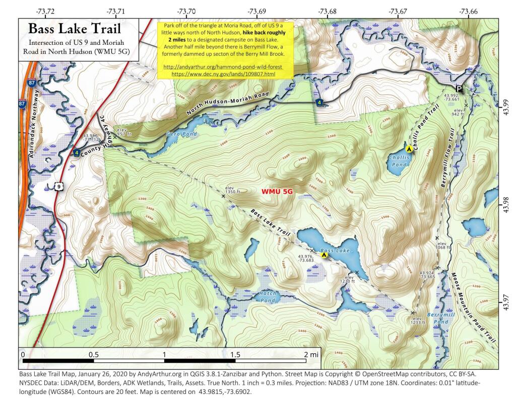
Park off of the triangle at Moria Road, off of US 9 a little ways north of North Hudson, hike back roughly 2 miles to a designated campsite on Bass Lake. Another half mile beyond there is Berrymill Flow, a formerly dammed up secton of the Berry Mill Brook.
http://andyarthur.org/hammond-pond-wild-forest
https://www.dec.ny.gov/lands/109807.html

Bookmark my free Interactive GPS Map for your phone:
https://andyarthur.org/ny
... shows your location as a blue dot in relationship to campsites, trails, state land. This online map requires cell service, won't work in remote country, so also bring a paper map.
Free Download of New & Historical USGS 1:24k Topograpic Maps
Interactive maps with backcountry and roadside camping: New York, Pennsylvania, West Virginia & Vermont. List of NYS DEC Lean-Tos and Firetowers.
Google Spreadsheet with Roadside, Primitive and Pay Campsites
More about Hammond Pond...
The Hammond Pond Wild Forest is located in the northeastern Adirondacks and the Lake Champlain Basin of Essex County. There are approximately 40,036 acres in the unit, which is situated in the Towns of Crown Point, Elizabethtown, Moriah, North Hudson, Schroon, Ticonderoga, and Westport.
http://www.cnyhiking.com/HammondPondWildForest.htm
Download the PDF Map Pack with All Maps from Hammond Pond.


