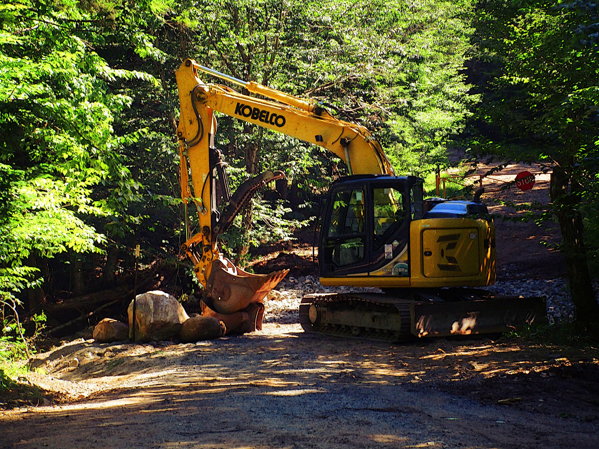
Work Continues On Brayhouse Brook Crossing  🖼️

Download a High Resolution JPEG Image of the Work Continues On Brayhouse Brook Crossing or an Adobe Acrobat Printable PDF of the Work Continues On Brayhouse Brook Crossing.

Work Continues On Brayhouse Brook Crossing ...

Coming back to the Potholers, I noted that Arietta has brought in an excavataotor and is hardening the crossing over Brayhouse Brook. They've added additional ourse rock, and have lined the edges of the culvert with heavy boulders. They've also done additional repairs to their section of the road just to south of the Potholers. I've been told that Stratford is working on repairing their bridge and will be re-grading their section of road in the coming weeks, to prepare the road for full opening by the start of hunting season on September 1st.

Taken on Saturday July 25, 2020 at Piseco-Powley Road.

Thematic Map: Voting Machines in Use in New York State

More about Piseco-Powley Road...

Stretching from Stratford to Piseco, Piseco-Powley Road winds along the western edge of one of the last remaining old Adirondack dirt roads. Lined with venerable spruce trees, some nearly brushing against the road, it offers a glimpse of nature's untouched beauty. The tranquil West Branch of the East Canada Creek intersects Powley Road at Powley Place. This spot is positioned 8 miles southwest of Piseco Outlet, where NY 10 crosses, and approximately 7.5 miles from the point Piseco-Powley Road branches off from NY 10. When approached from the south, Powley Place is found 10.5 miles northeast from Stratford via Piseco Road. Notably, this area hosts four campsites, forming part of the 22 designated camping spots along Piseco-Powley Road, enhancing the allure of this picturesque route.

http://www.dec.ny.gov/lands/28339.html

Get maps of campsites and destinations as a single-page PDF here: https://www.scribd.com/document/640949248/Piseco-Powley-Road-Campsite-Map-Pack

Map: Big Alderbed Lake Trail
Map: Clockmill Corners to NY 10
Map: Goldmine Stream Falls
Map: House Pond Trail
Map: Lower Powley Bridge to Sugarbush Mountain
Map: Meco Lake Trail (Piseco-Powley Road)
Map: Overview Map Piseco-Powley Road
Map: Powley Place - East Canada Creek - Kayak Canoe
Map: Sand Lake
Map: Sand Lake Trail
Map: Sugarbush Mountain to Clockmill Corners
Terrain Map: Edick Road Swimming Hole
Terrain Map: Juneteenth 2022 Weekend
Terrain Map: Powley Road
Thematic Map: Piseco Road Swimming Holes
Photo: Reds
Photo: Fire
Photo: Campsite No 10
Photo: Same campsite I sprained my ankle in one year ago. This time, used a step stool
Photo: Lazy Sunday
Photo: Morning at Powley Place
Photo: The Fire
Photo: Sunday breakfast
Photo: Swimming Hole Off Old Edick Road
Photo: Bridge lit up

Leave a Reply

Your email address will not be published. Required fields are marked *