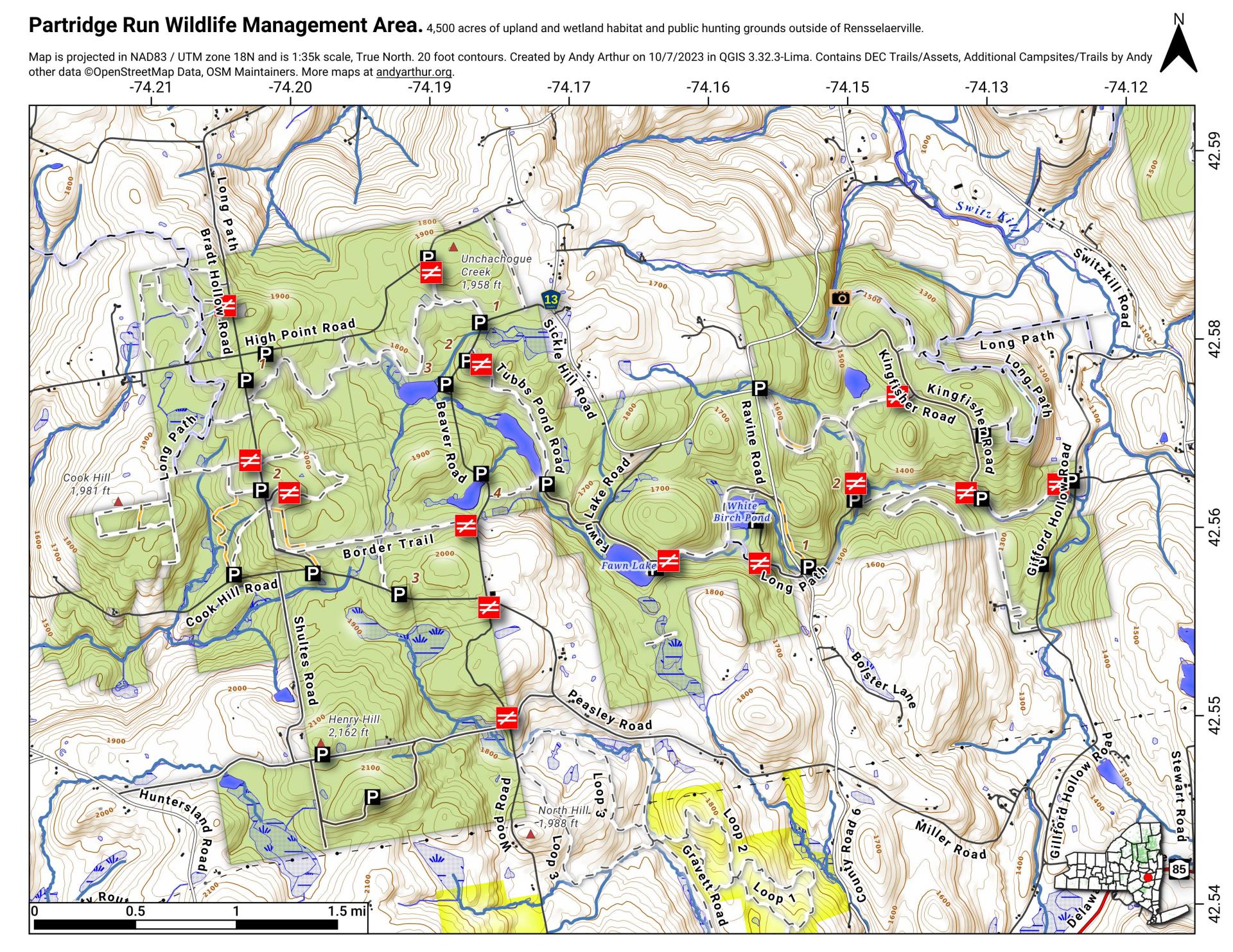
Partridge Run WMA

Download a High Resolution JPEG Image of the Partridge Run WMA or an Adobe Acrobat Printable PDF of the Partridge Run WMA.


Bookmark my free Interactive GPS Map for your phone:
https://andyarthur.org/ny
... shows your location as a blue dot in relationship to campsites, trails, state land. This online map requires cell service, won't work in remote country, so also bring a paper map.
Free Download of New & Historical USGS 1:24k Topograpic Maps
Interactive maps with backcountry and roadside camping: New York, Pennsylvania, West Virginia & Vermont. List of NYS DEC Lean-Tos and Firetowers.
Google Spreadsheet with Roadside, Primitive and Pay Campsites
More about Partridge Run Game Management Area...
Partridge Run Wildlife Management Area (WMA) consists of about 4500 acres of upland and wetland habitat in Albany County. It is located in the Town of Berne. The majority of the current WMA was transferred to the New York State in 1962 by the federal government. The WMA can be access from County Rt. 13, County Rt. 6 and a number of town roads. Numerous parking areas are located throughout the WMA. This parcel of public land affords multiple uses for outdoor recreation including hunting, trapping, fishing, birding, hiking, snowmobiling, skiing, and horseback riding.
http://www.dec.ny.gov/outdoor/86068.html


