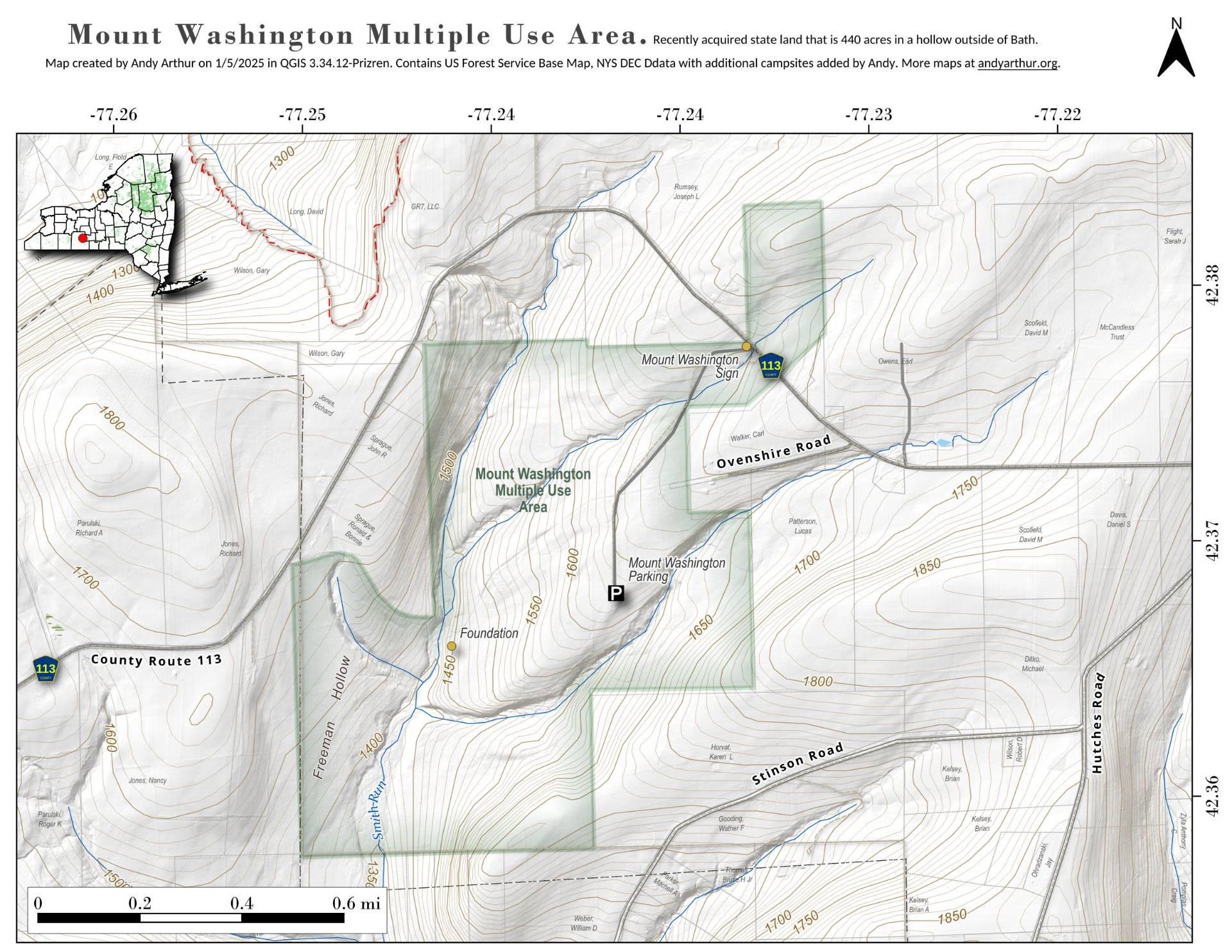
Mount Washington Multiple Use Area

Download a High Resolution JPEG Image of the Mount Washington Multiple Use Area or an Adobe Acrobat Printable PDF of the Mount Washington Multiple Use Area.


Bookmark my free Interactive GPS Map for your phone:
https://andyarthur.org/ny
... shows your location as a blue dot in relationship to campsites, trails, state land. This online map requires cell service, won't work in remote country, so also bring a paper map.
Free Download of New & Historical USGS 1:24k Topograpic Maps
Interactive maps with backcountry and roadside camping: New York, Pennsylvania, West Virginia & Vermont. List of NYS DEC Lean-Tos and Firetowers.
Google Spreadsheet with Roadside, Primitive and Pay Campsites
More about Steuben County...
Steuben County /stuːˈbɛn/ is a county located in the U.S. state of New York. As of the 2010 census, the population was 98,990.[1] Its name is in honor of Baron von Steuben, a German general who fought on the American side in the American Revolutionary War, though it is not pronounced the same. Its county seat is Bath.
Steuben County is in the southwestern part of New York State, immediately north of the Pennsylvania border. The population of Steuben County according to the 2000 U. S. census was 98,726. The county is in the Southern Tier region of New York State.
http://en.wikipedia.org/wiki/Steuben_County,_New_York
Download the PDF Map Pack with All Maps from Steuben County.


