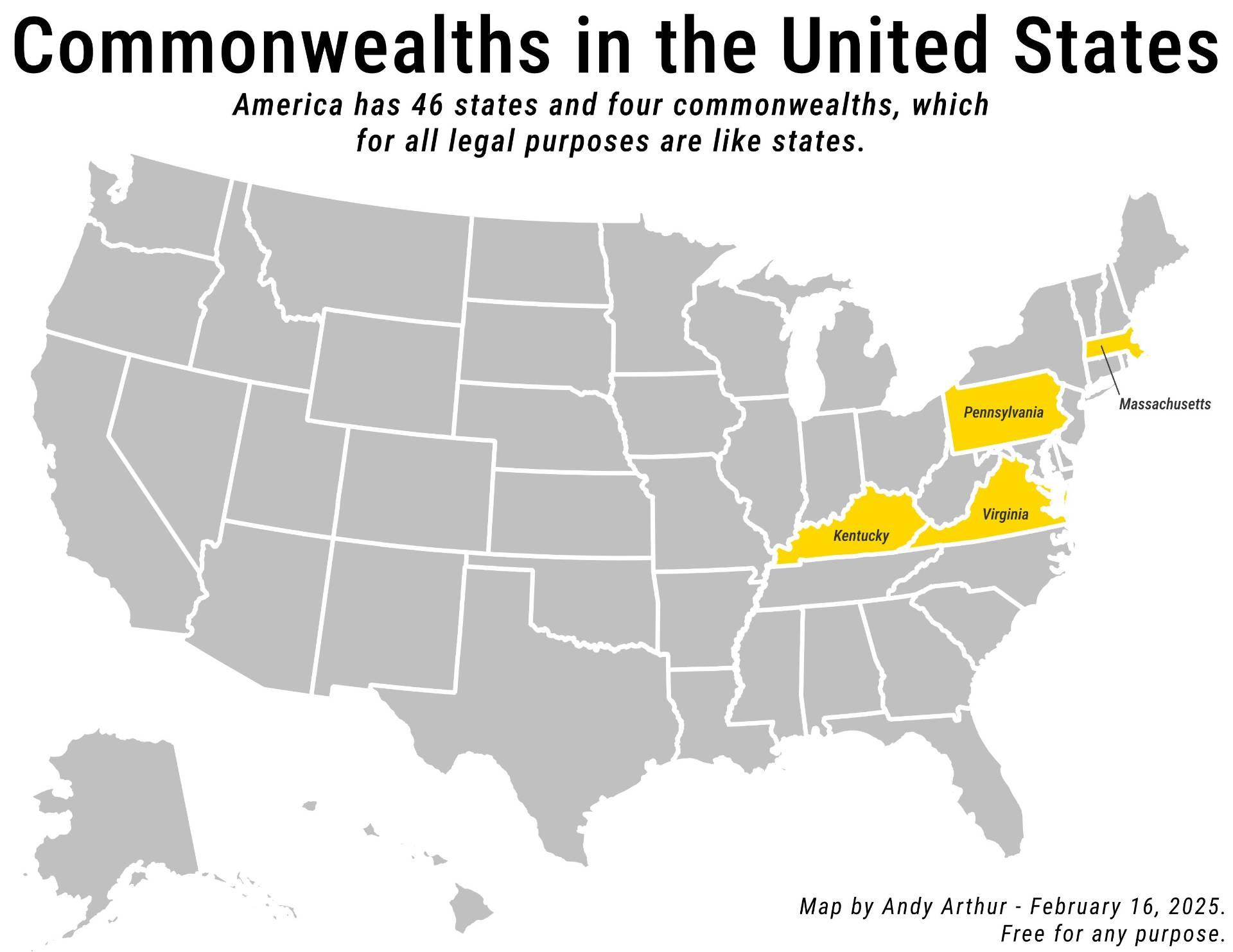
Commonwealths in the United States 🗺️
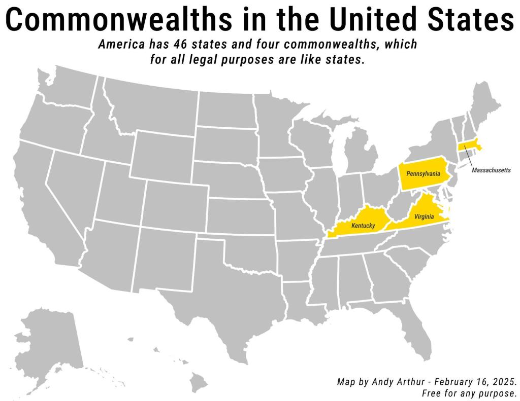
Download a High Resolution JPEG Image of the Commonwealths in the United States or an Adobe Acrobat Printable PDF of the Thematic Commonwealths in the United States.

More about Other States...
Exploring various other places outside of New York State, including Pennsylvania, Vermont, and Massachusetts.


