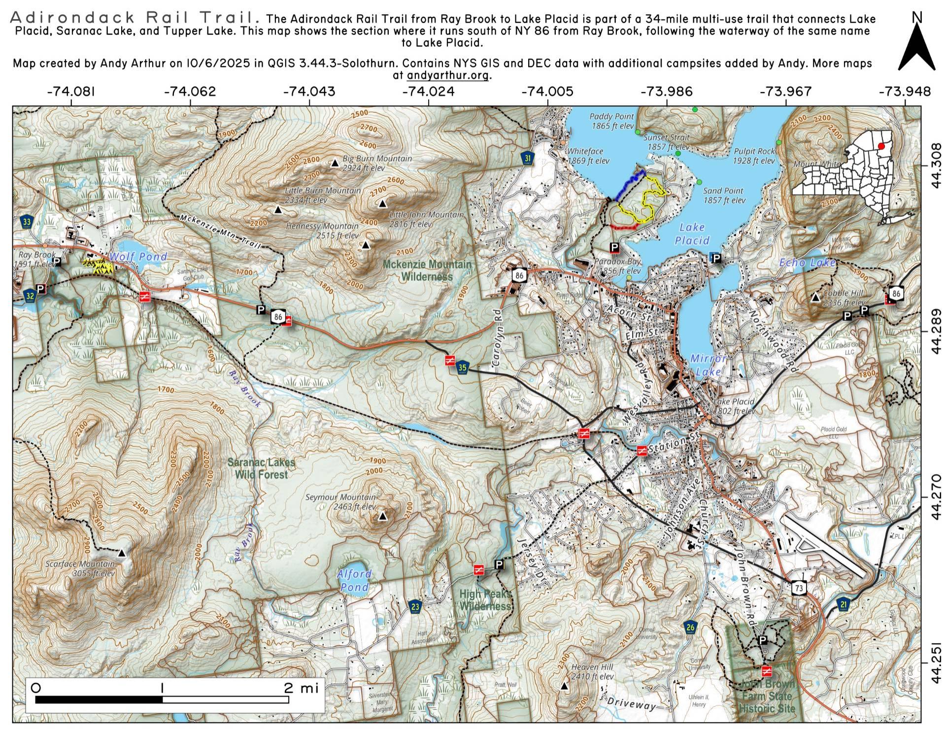
Adirondack Rail Trail – Ray Brook to Lake Placid

Download a High Resolution JPEG Image of the Adirondack Rail Trail - Ray Brook to Lake Placid or an Adobe Acrobat Printable PDF of the Adirondack Rail Trail - Ray Brook to Lake Placid.


Bookmark my free Interactive GPS Map for your phone:
https://andyarthur.org/ny
... shows your location as a blue dot in relationship to campsites, trails, state land. This online map requires cell service, won't work in remote country, so also bring a paper map.
Free Download of New & Historical USGS 1:24k Topograpic Maps
Interactive maps with backcountry and roadside camping: New York, Pennsylvania, West Virginia & Vermont. List of NYS DEC Lean-Tos and Firetowers.
Google Spreadsheet with Roadside, Primitive and Pay Campsites
More about Adirondack Rail Trail...
The Adirondack Rail Trail from Tupper Lake to Rollins Pond is part of a 34-mile multi-use trail that connects Lake Placid, Saranac Lake, and Tupper Lake. Surface: The trail will feature a mixed variety of surfaces, including large crushed stone and sand, with occasional rail tie fragments and small metal pieces. You may want to bring an air pump and spare tubes. The trail has a gentle grade, with a maximum slope of 5% and a typical slope of 2%, making it accessible to users of all ages and abilities. The trail has a typical width of 5 feet. Parking areas, rest stops, kiosks, and educational signs will be available along the trail.
Download the PDF Map Pack with All Maps from Adirondack Rail Trail.


