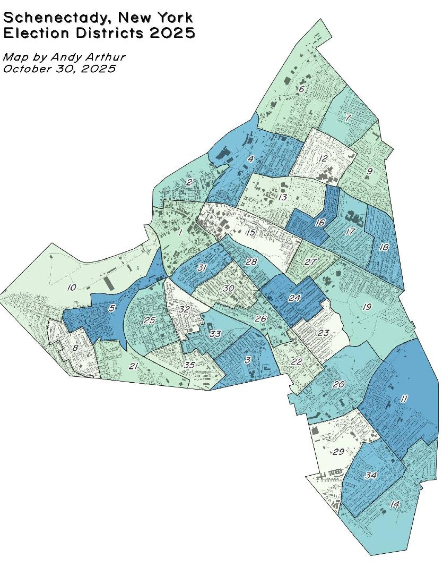
Schenectady NY Election Districts 🗺️

Download a High Resolution JPEG Image of the Schenectady NY Election Districts or an Adobe Acrobat Printable PDF of the Thematic Schenectady NY Election Districts.

More about Schenectady County...
Schenectady County is a county located in the U.S. state of New York. As of the 2010 census, the population was 154,727. It is part of the Albany-Schenectady-Troy Metropolitan Statistical Area. The county seat is Schenectady. Schenectady County is located west of Albany on the Mohawk River, and contains both the river and uplands around it.


