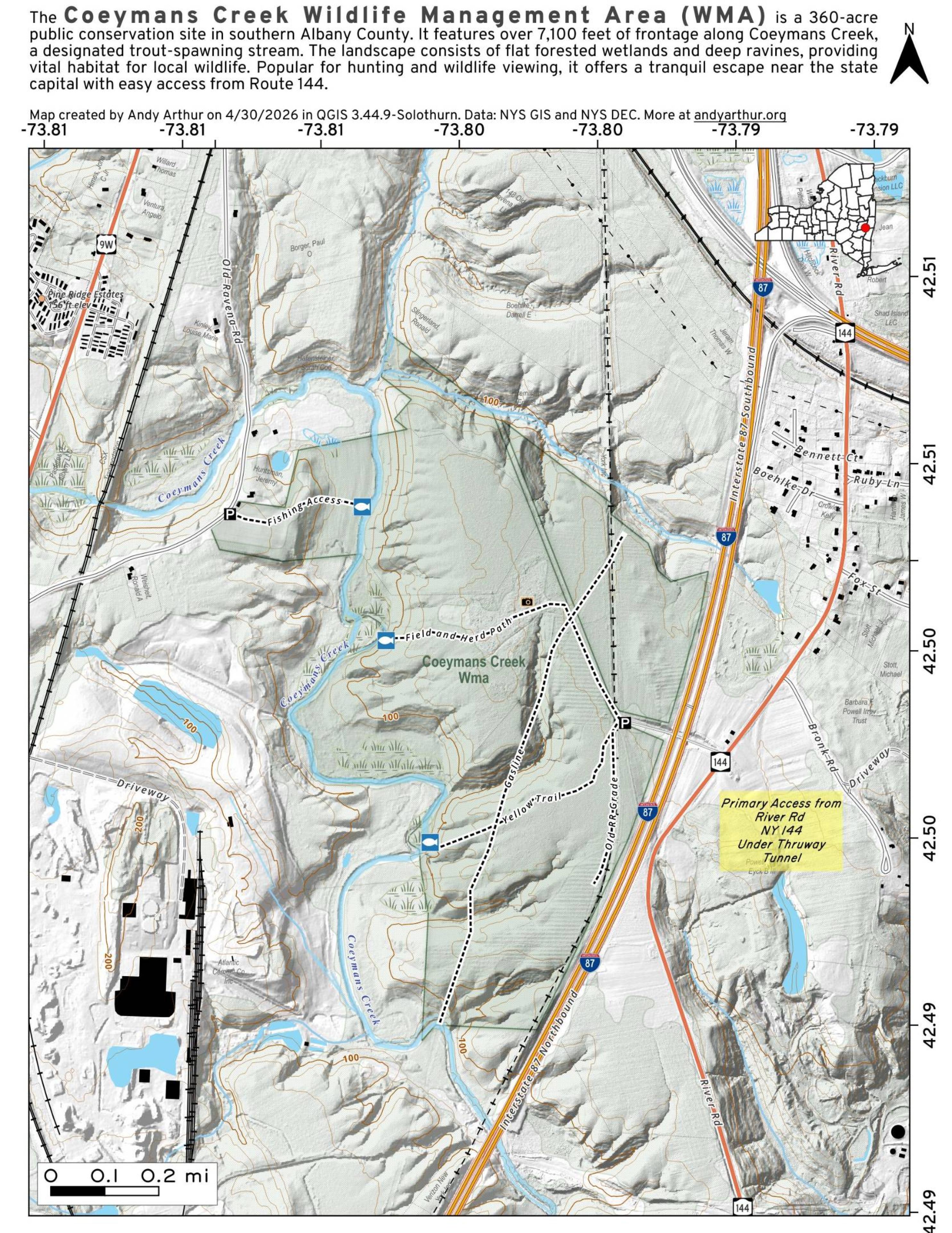
Coeymans Creek WMA
Download a High Resolution JPEG Image of the Coeymans Creek WMA or an Adobe Acrobat Printable PDF of the Coeymans Creek WMA.


Bookmark my free Interactive GPS Map for your phone:
https://andyarthur.org/ny
... shows your location as a blue dot in relationship to campsites, trails, state land. This online map requires cell service, won't work in remote country, so also bring a paper map.
Free Download of New & Historical USGS 1:24k Topograpic Maps
Interactive maps with backcountry and roadside camping: New York, Pennsylvania, West Virginia & Vermont. List of NYS DEC Lean-Tos and Firetowers.
Google Spreadsheet with Roadside, Primitive and Pay Campsites
More about Coeymans Creek Wildlife Management Area...
In the mid-1990s, Albany purchased several large parcels of land in Coeymans across from the LaFarge Cement Plant on Coeymans Creek for purposes of constructing a regional landfill. Ultimately, these lands were sold to the state for purposes of public hunting grounds.
There are 358 acres of state land that can be accessed via Old Ravena Road and Stylabrick Road, providing access to the Coeymans Creek behind the cement plant, along the Thruway.
http://andyarthur.org/coeymans-creek-wma


