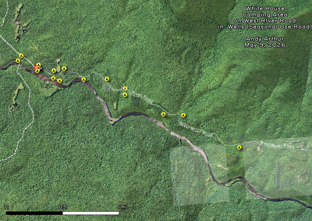
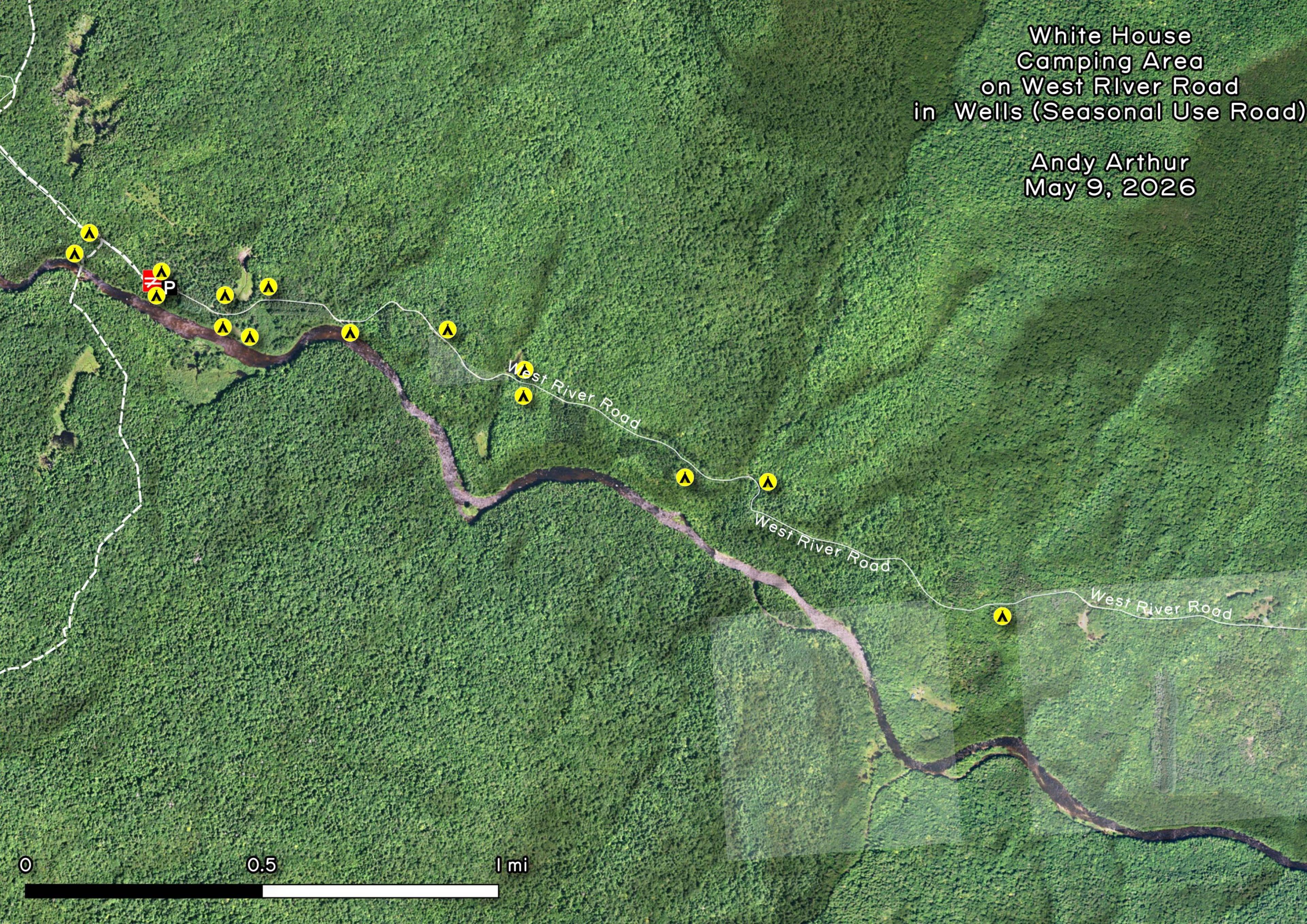
White House Camping Area on West River Road in Wells
Download a High Resolution JPEG Image of the White House Camping Area on West River Road in Wells or an Adobe Acrobat Printable PDF of the White House Camping Area on West River Road in Wells.


Bookmark my free Interactive GPS Map for your phone:
https://andyarthur.org/ny
... shows your location as a blue dot in relationship to campsites, trails, state land. This online map requires cell service, won't work in remote country, so also bring a paper map.
Free Download of New & Historical USGS 1:24k Topograpic Maps
Interactive maps with backcountry and roadside camping: New York, Pennsylvania, West Virginia & Vermont. List of NYS DEC Lean-Tos and Firetowers.
Google Spreadsheet with Roadside, Primitive and Pay Campsites
More about Whitehouse, NY...
West River Road currently goes 7 miles from Wells to the old ghost town of Whitehouse, complete with two historic chimneys and several campsites. A scenic area, with views of the West Branch of Sacanadaga River and Dugaway Mountain. There is an old cementary located up there, along with one of the biggest pedestrian suspension bridges in Adirondacks. The Northville-Placid Trail also runs about a 1/4 mile from Whitehouse, and is frequently accessed from the Whitehouse Parking Area.
Although a long distance trail many people use the Northville-Placid Trail to access the wilderness for day trips. The Whitehouse Trailhead is used for short hikes across a unique suspension bridge over the West Branch of the Sacandaga River. Other popular destinations from Whitehouse include Big Eddy, Mud Lake, and Hamilton Lake Stream.
While the state has been trying to close off West River Road since the initial purchase of Whitehouse in the early 1970s, as early as 1972 it was proposed to be added to Silver Lake Wilderness. The latest 2006 Silver Lake Wilderness Unit Management Plan also calls for closure of the road, but no action has been taken, the road is still well maintained by the Town of Wells all the way out Whitehouse.
http://www.dec.ny.gov/lands/100874.html
Download the PDF Map Pack with All Maps from Whitehouse, NY.


