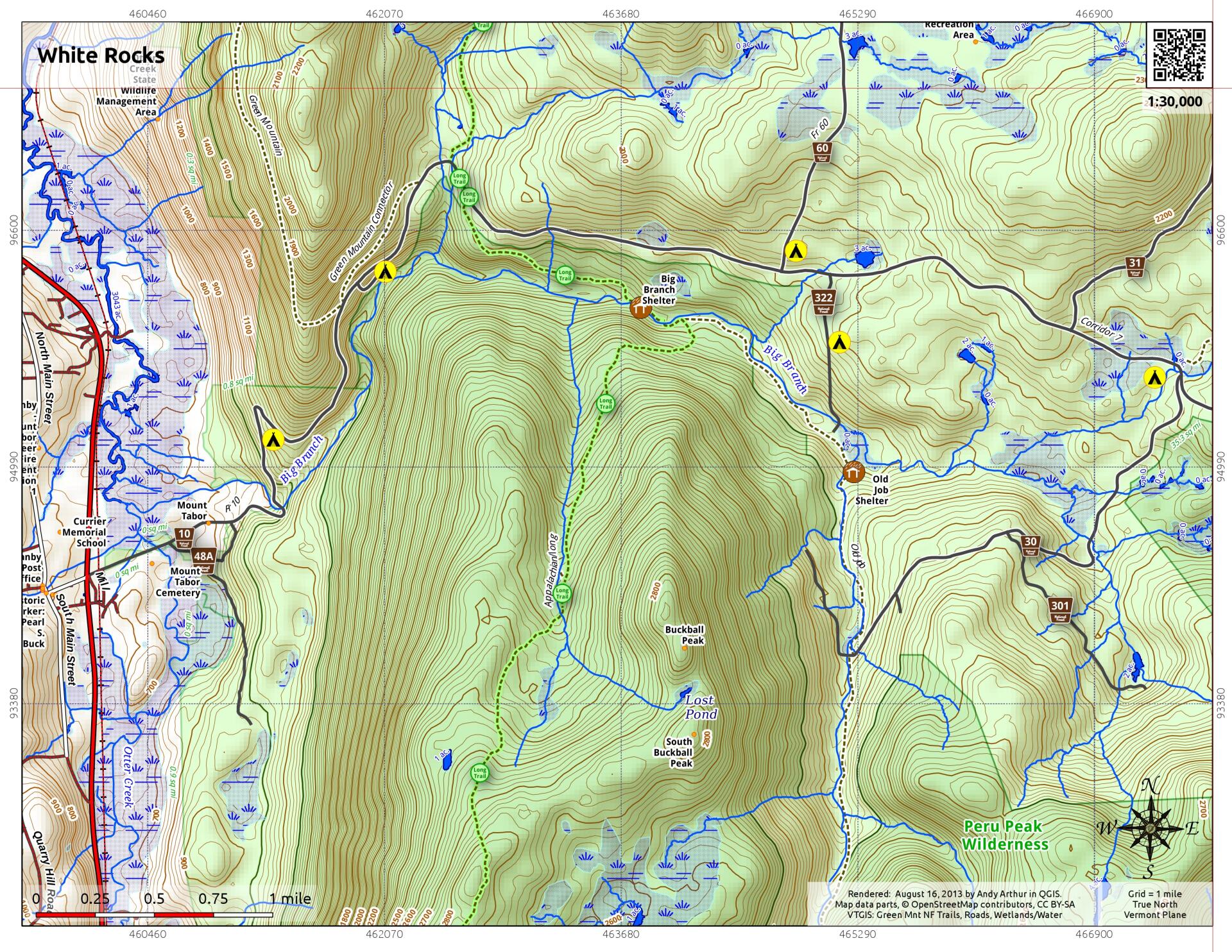
White Rocks

Download a High Resolution JPEG Image of the White Rocks or an Adobe Acrobat Printable PDF of the White Rocks.


Bookmark my free Interactive GPS Map for your phone:
https://andyarthur.org/ny
... shows your location as a blue dot in relationship to campsites, trails, state land. This online map requires cell service, won't work in remote country, so also bring a paper map.
Free Download of New & Historical USGS 1:24k Topograpic Maps
Interactive maps with backcountry and roadside camping: New York, Pennsylvania, West Virginia & Vermont. List of NYS DEC Lean-Tos and Firetowers.
Google Spreadsheet with Roadside, Primitive and Pay Campsites
More about White Rocks National Recreation Area...
White Rocks National Recreation Area is a United States National Recreation Area located in southern Vermont, United States, within the Green Mountain National Forest. The Peru Peak and Big Branch Wilderness areas are within White Rocks NRA. On January 17, 2006 President George W. Bush signed Pub.L. 110–1, which renamed the park to the Robert T. Stafford White Rocks National Recreation Area, after Robert Stafford, former Governor of Vermont, United States Representative, and U.S. Senator.
Recreational activities include camping and hiking on a 30 mile (48 kilometer) section of the Appalachian Trail that traverses the recreation area. There are also 61 miles (97.6 kilometers) of maintained snowmobile trails within the recreation area. Chaos Canyon is a cleft in a giant quartzite rockslide in the Area.
The main road through the White Rocks National Recreation Area is Forest Road 10, which is also known as Danby-Landgrove Road. It home to many campsites.
http://en.wikipedia.org/wiki/White_Rocks_National_Recreation_Area


