Moss Island
Download a High Resolution JPEG Image of the Moss Island or an Adobe Acrobat Printable PDF of the Moss Island.


Bookmark my free Interactive GPS Map for your phone:
https://andyarthur.org/ny
... shows your location as a blue dot in relationship to campsites, trails, state land. This online map requires cell service, won't work in remote country, so also bring a paper map.
Free Download of New & Historical USGS 1:24k Topograpic Maps
Interactive maps with backcountry and roadside camping: New York, Pennsylvania, West Virginia & Vermont. List of NYS DEC Lean-Tos and Firetowers.
Google Spreadsheet with Roadside, Primitive and Pay Campsites
More about Moss Island...
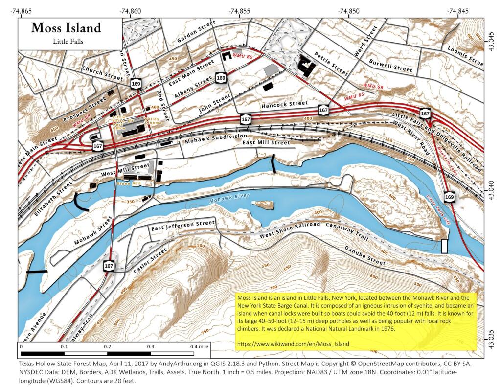
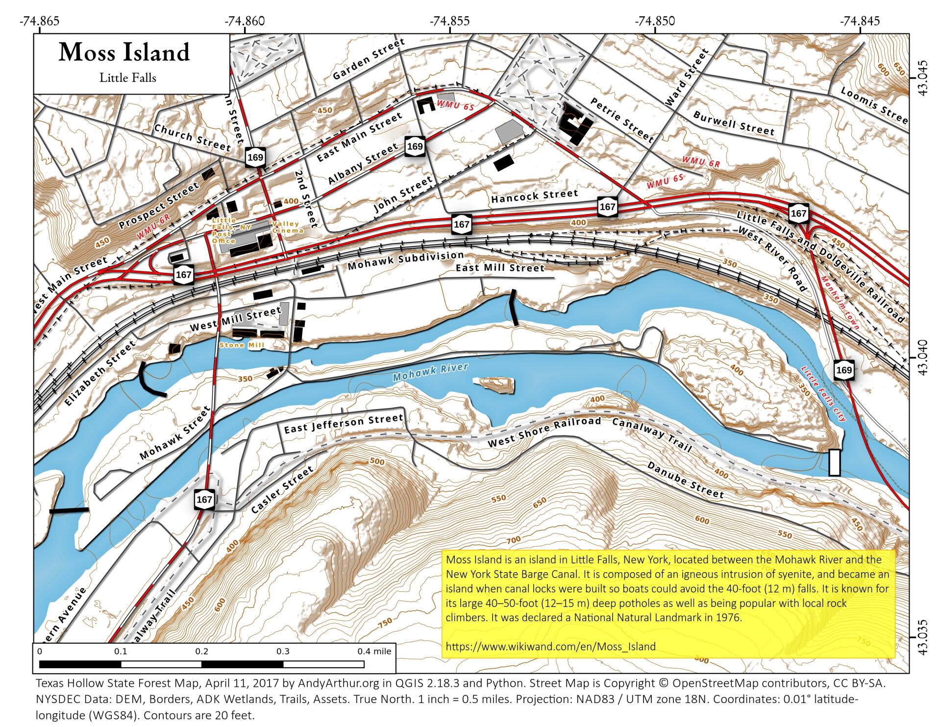
Moss Island is an island in Little Falls, New York, located between the Mohawk River and the New York State Barge Canal. It is composed of an igneous intrusion of syenite, and became an island when canal locks were built so boats could avoid the 40-foot (12 m) falls. It is known for its large 40–50-foot (12–15 m) deep potholes as well as being popular with local rock climbers. It was declared a National Natural Landmark in 1976.
https://www.wikiwand.com/en/Moss_Island
Some of the back story on Moss Island and the fight to save it, along with Lynne Jackson and Dan Van Riper's trip to Moss Island can be found here: http://www.albanyweblog.com/2008/08-aug/08-08-08.php
See this 1976 Documentary on the proposed bridge over Moss Island and the fight to save Moss Island on Youtbue: https://www.youtube.com/watch?v=cOwYEhJuAc8
See the 1977 Revised Environmental Impact Statement on Southeast Arterial Hwy, Route 169 Replacement, Little Falls.
https://books.google.com/books?id=QqY1AQAAMAAJ


