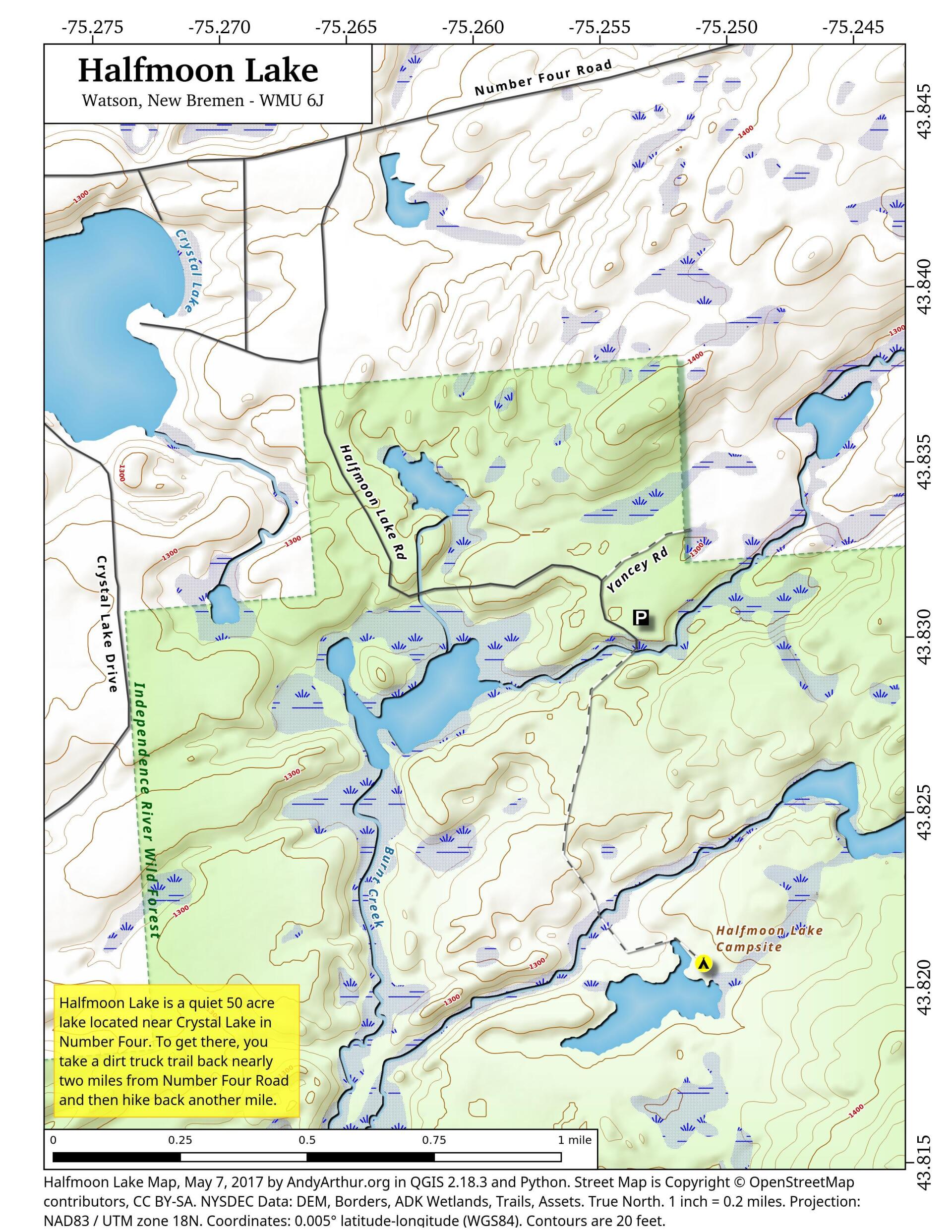
Halfmoon Lake
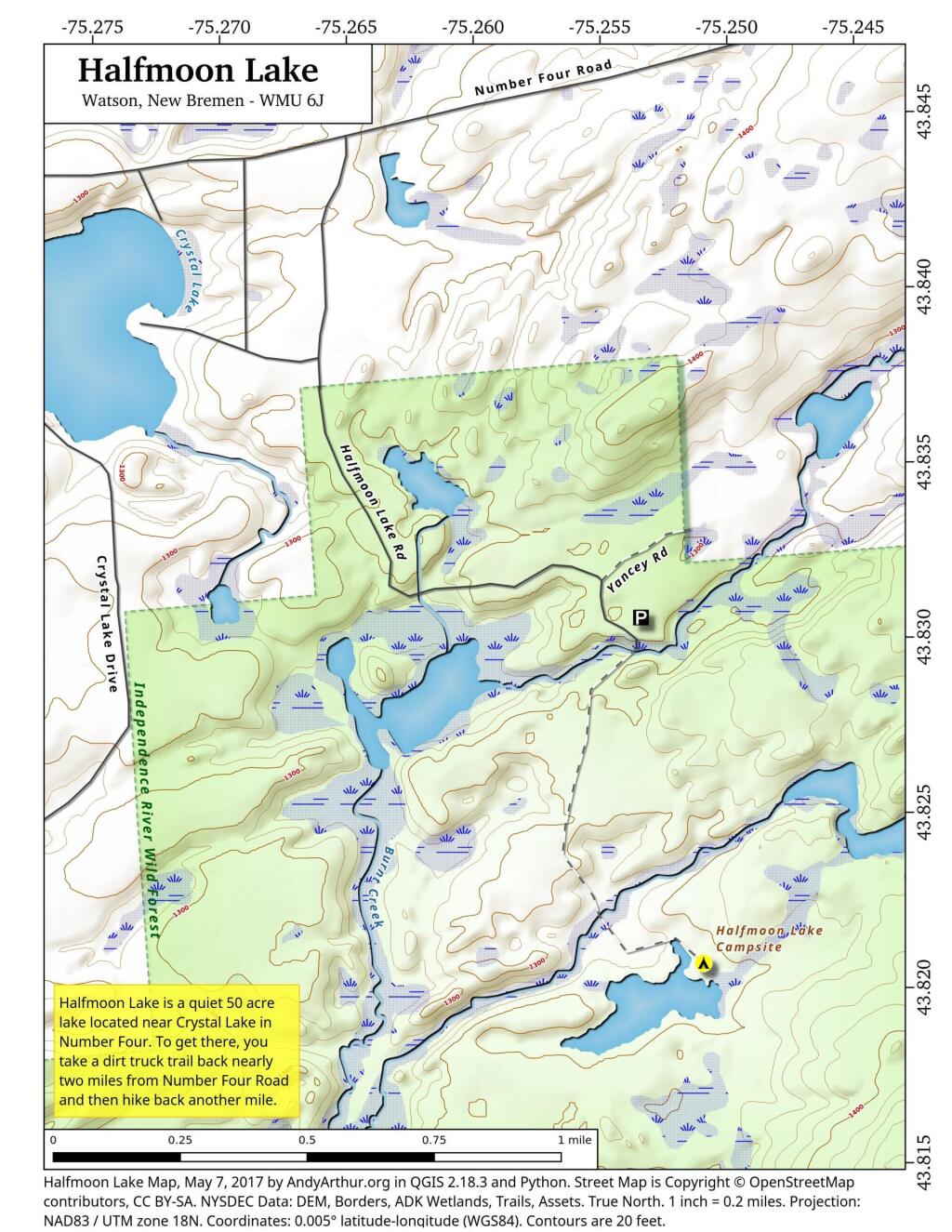
Download a High Resolution JPEG Image of the Halfmoon Lake or an Adobe Acrobat Printable PDF of the Halfmoon Lake.


Bookmark my free Interactive GPS Map for your phone:
https://andyarthur.org/ny
... shows your location as a blue dot in relationship to campsites, trails, state land. This online map requires cell service, won't work in remote country, so also bring a paper map.
Free Download of New & Historical USGS 1:24k Topograpic Maps
Interactive maps with backcountry and roadside camping: New York, Pennsylvania, West Virginia & Vermont. List of NYS DEC Lean-Tos and Firetowers.
Google Spreadsheet with Roadside, Primitive and Pay Campsites
More about Independence River...
The Independence River Wild Forest is described as the Western Adirondack Preserve acreage lying adjacent to the western boundary of the Adirondack Park including the western portions of the Otter Creek and Independence River watersheds, extending from Lewis County into Herkimer County northeast along the south side of the Beaver River and Stillwater Reservoir and south of Beaver River.
Included are lands in Watsons East Triangle, Brantingham Tract, Macomb's Purchase and John Brown Tract, encompassing both Lewis and Herkimer Counties. USGS 15½ minute quadrangle maps that cover this unit are: Big Moose, Lowville, Mc Keever, Number Four and Port Leyden.
Bounded by:
North: Number 4 Road; Stillwater Reservoir;
West: Exterior Forest Preserve Boundaries in the Towns of Greig, Lyonsdale and Watson; and Adirondack Park boundary;
South: Ha-De-Ron-Dah Wilderness;
East: railroad tract from big Moose to Beaver River Station, Former International Paper Company lands.
http://www.dec.ny.gov/lands/58192.html
Download the PDF Map Pack with All Maps from Independence River.


No Comments
9/12/2022. Me & my hiking pal, (dog)Odin hiked to Halfmoon Lake. Found the dirt forest road matked “Private Road” easily. Road was well groomed and easy to drive in my non four wheel drive car.
The foot bridge over the Burnt Creek was a strong metal,mesh type which made crossing that creek EASY!
The foot path is quite wide, well defined and NOT marked (except for 2 yellow trail blazes on one tree)
There is a large blue tarp hunting camp(?)to your right as you walk along the trail. It took us a total of about 20 minutes to walk from car to lakeside! Very peaceful, quiet lake! Some beaver activity noted. Lots of wild cranberries around the campsite! Beautiful day and even better destination! We were the only ones there all day!