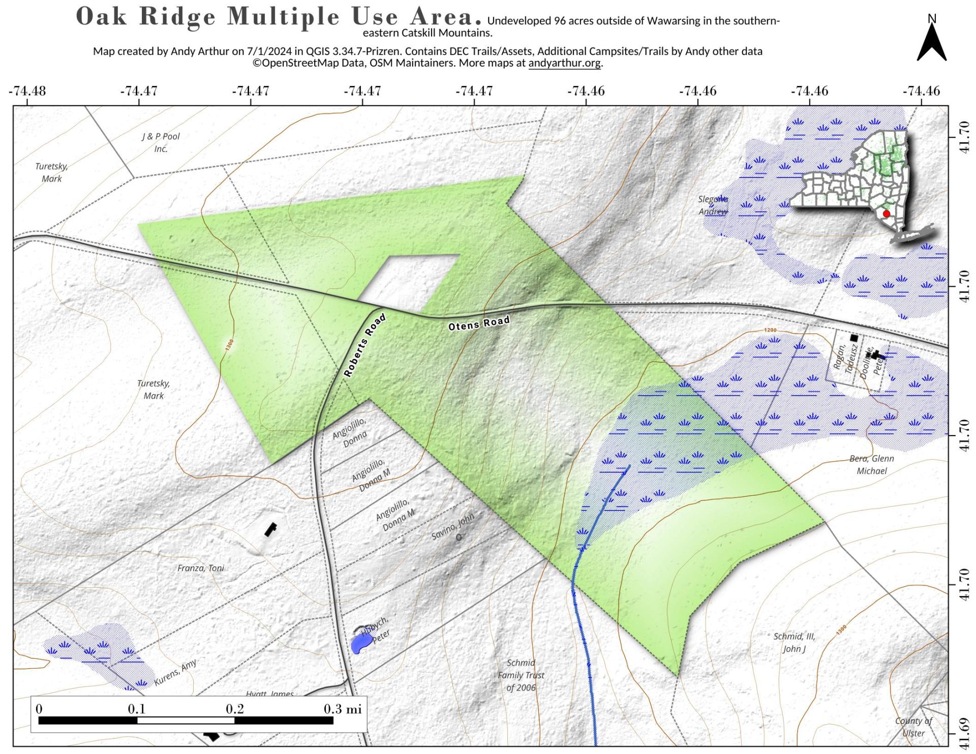
Oak Ridge Multiple Use Area

Download a High Resolution JPEG Image of the Oak Ridge Multiple Use Area or an Adobe Acrobat Printable PDF of the Oak Ridge Multiple Use Area.


Bookmark my free Interactive GPS Map for your phone:
https://andyarthur.org/ny
... shows your location as a blue dot in relationship to campsites, trails, state land. This online map requires cell service, won't work in remote country, so also bring a paper map.
Free Download of New & Historical USGS 1:24k Topograpic Maps
Interactive maps with backcountry and roadside camping: New York, Pennsylvania, West Virginia & Vermont. List of NYS DEC Lean-Tos and Firetowers.
Google Spreadsheet with Roadside, Primitive and Pay Campsites
More about Oak Ridge State Forest...
Oak Ridge State Forest is located northeast of the village of Afton. It is a hilltop forest, except on the eastern side, where there is a 300± foot deep ravine that mother nature carved with a small stream flowing off the hilltop. The most common visitors to the forests are hunter and woodland hikers. Purchased with Hewitt Amendment funds in the 1930's, the State Forest is a blend of planted forests of red pine, larch and Norway spruce, and natural forest stands consisting mostly of red maple, red oak, chestnut oak, white oak, American beech, white ash, hickories, white pine and eastern hemlock. The plantations were mostly planted by Civil Conservation Corps in the 1930's.
http://www.dec.ny.gov/lands/8141.html
Download the PDF Map Pack with All Maps from Oak Ridge State Forest.
