North Point Trail

Download a High Resolution JPEG Image of the North Point Trail or an Adobe Acrobat Printable PDF of the North Point Trail.


Bookmark my free Interactive GPS Map for your phone:
https://andyarthur.org/ny
... shows your location as a blue dot in relationship to campsites, trails, state land. This online map requires cell service, won't work in remote country, so also bring a paper map.
Free Download of New & Historical USGS 1:24k Topograpic Maps
Interactive maps with backcountry and roadside camping: New York, Pennsylvania, West Virginia & Vermont. List of NYS DEC Lean-Tos and Firetowers.
Google Spreadsheet with Roadside, Primitive and Pay Campsites
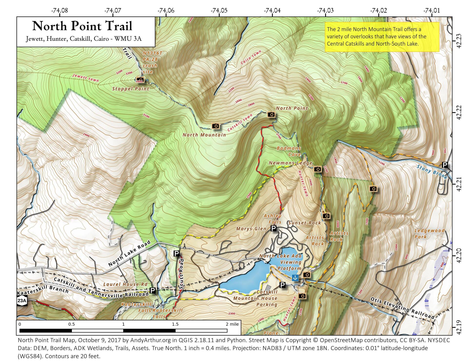
More about North South Lake...
North-South Lake is the biggest and most popular state campground in the Catskill Forest Preserve, offering extraordinary scenic beauty, and historical sites, such as: Alligator Rock, Kaaterskill Falls, and the former site of the Catskill Mountain House.
An abrupt change in elevation occurs from about 540 feet above sea level at the base of the escarpment to approximately 2,250 feet at the site of the former Catskill Mountain House. The provinces around the lakes have long provided visitors with exceptional views of the surrounding countryside. It is said that on a clear day, five states can be viewed from the escarpment.
http://www.dec.ny.gov/outdoor/24487.html
Download the PDF Map Pack with All Maps from North South Lake.


