Skip to the content
Andy Arthur.org
Super Duty dreams and off-grid schemes.
Skip to Content
Site Navigation ▼
Search for:
NYS Campsites
NYS Lean-Tos
NYS Firetowers
Places to Camp, Hunt, Hike
Find Property Owners, School Districts
The Off-Grid Future
Planning a Trip to Upper Peninsula Michigan
The F-350 SuperDuty
Living Healthy in My Forties
Silly Business of Politics
Climate Change & Greenies
Computers, Programming and Open Source Software
Neat Things You Can do With Public Data
Privacy Policy
Why Ads?
Moose River Plains
Piseco-Powley
Finger Lakes NF
Burnt-Rossman Hills
Charles Baker SF
East Branch Sacandaga
Great Western Turnpike
Rogers Environmental Education Center
Notes
Rexford Falls
Glimmerglass State Park
Five Rivers Environmental Education Center
Exploring the Apartment
Seasons
Bennett Hill Preserve
CDTA Route 18
Hudson
New York City
NYS Census - Population
US Census 📍
Maps that look at the US Census at the macro-perspective of all counties in the United States.
📽️
Videos
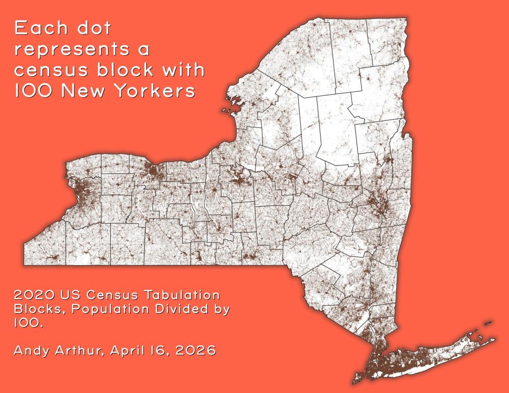
Each dot represents a census block with 100 New Yorkers
Andy
|
November 4, 2026
Population Born Out of State
Andy
|
October 31, 2026
us-state-pop-density-1900
Andy
|
October 6, 2026
How Asians Voted in NYS in 2020
Andy
|
September 28, 2026
2020 State Population Density
Andy
|
August 13, 2026
Posts navigation
←
older