Roosevelt Truck Trail
Download a High Resolution JPEG Image of the Roosevelt Truck Trail or an Adobe Acrobat Printable PDF of the Roosevelt Truck Trail.
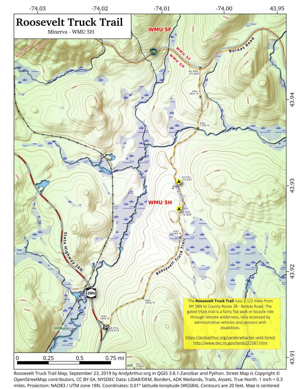
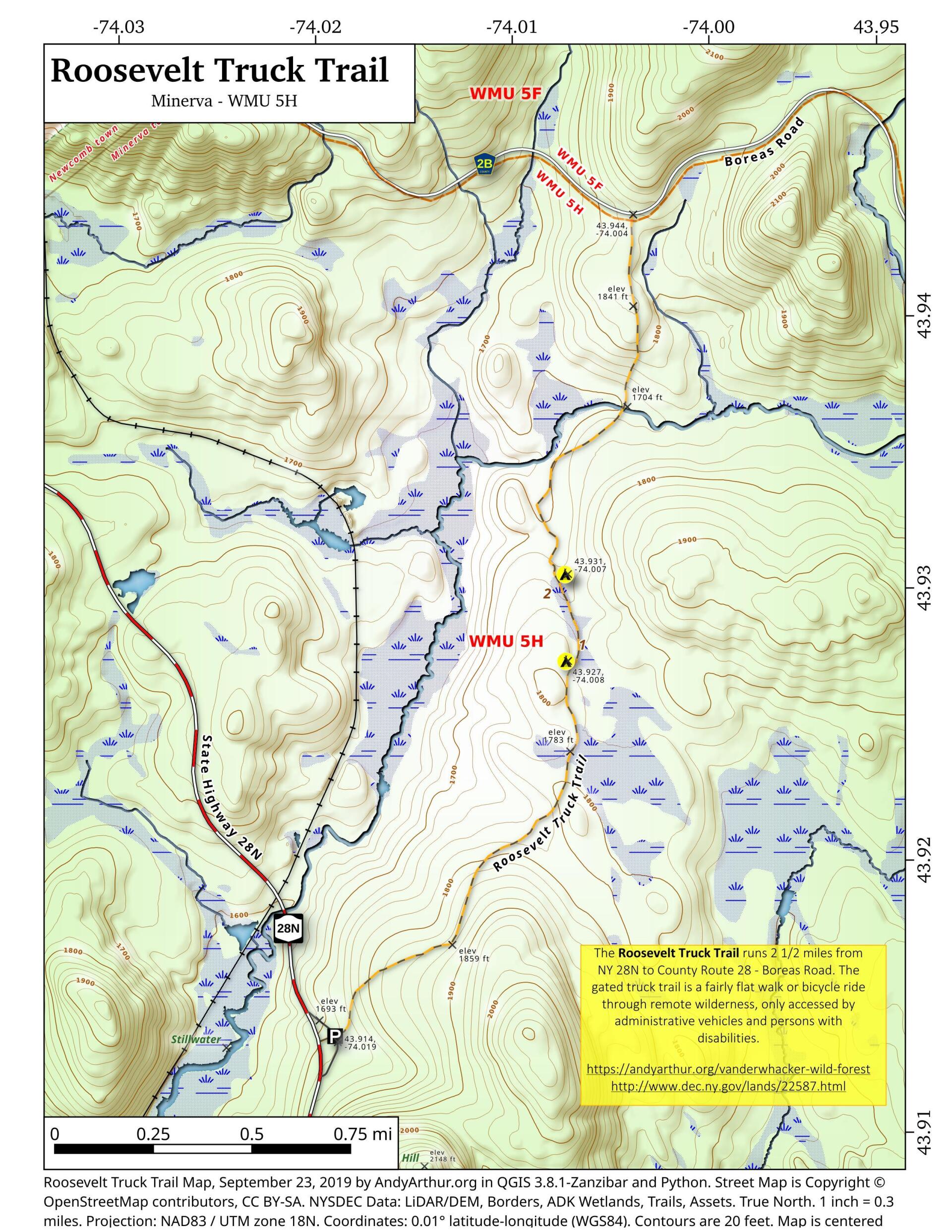
About Map: Roosevelt Truck Trail ....
The Roosevelt Truck Trail runs 2 1/2 miles from NY 28N to County Route 28 - Boreas Road. The gated truck trail is a fairly flat walk or bicycle ride through remote wilderness, only accessed by administrative vehicles and persons with disabilities.
https://andyarthur.org/vanderwhacker-wild-forest
http://www.dec.ny.gov/lands/22587.html

Bookmark my free Interactive GPS Map for your phone:
https://andyarthur.org/ny
... shows your location as a blue dot in relationship to campsites, trails, state land. This online map requires cell service, won't work in remote country, so also bring a paper map.
Free Download of New & Historical USGS 1:24k Topograpic Maps
Interactive maps with backcountry and roadside camping: New York, Pennsylvania, West Virginia & Vermont. List of NYS DEC Lean-Tos and Firetowers.
Google Spreadsheet with Roadside, Primitive and Pay Campsites
More about Vanderwhacker Mountain Wild Forest...
Vanderwhacker Mountain Wild Forest is a 91,854-acre public preserve in New York’s Adirondack Park. The diverse terrain features quiet lakes, vast wetlands, and rugged peaks. The highlight is the 3,386-foot Vanderwhacker Mountain, which features a restored fire tower offering panoramic views of the High Peaks. Visitors enjoy primitive camping, backcountry hiking, paddling, and snowmobiling. It provides a peaceful, less-crowded wilderness experience for outdoor enthusiasts seeking rugged Adirondack beauty.
Download the PDF Map Pack with All Maps from Vanderwhacker Mountain Wild Forest.


No Comments
Thanks Andy. This map is perfect. We are going to explore the truck trail tomorrow. Trudy