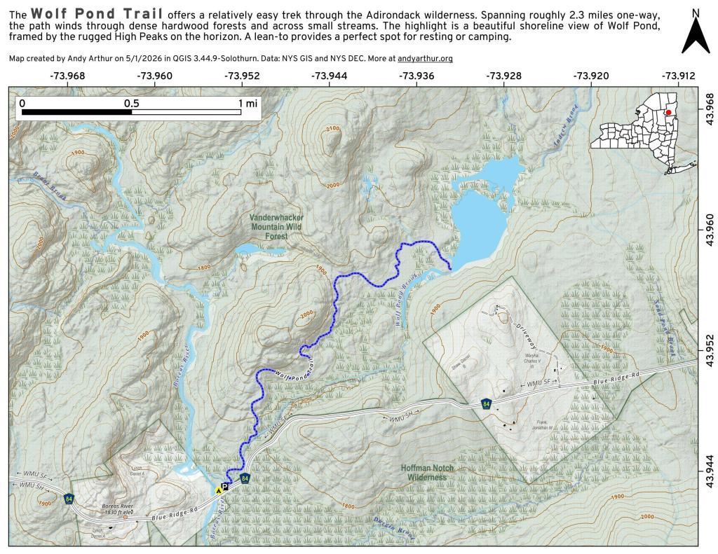
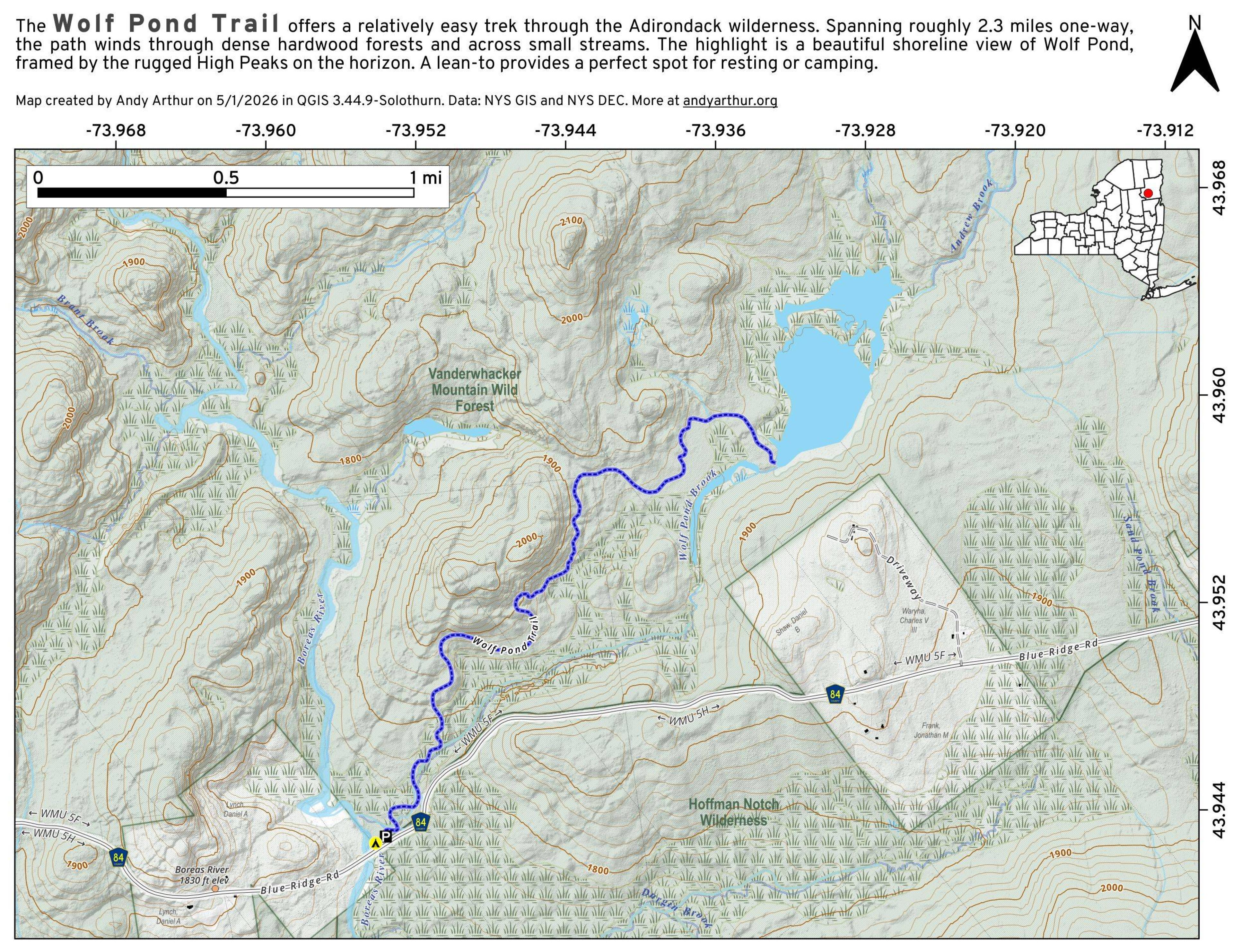
Wolf Pond Trail
Download a High Resolution JPEG Image of the Wolf Pond Trail or an Adobe Acrobat Printable PDF of the Wolf Pond Trail.

Bookmark my free Interactive GPS Map for your phone:
https://andyarthur.org/ny
... shows your location as a blue dot in relationship to campsites, trails, state land. This online map requires cell service, won't work in remote country, so also bring a paper map.
Free Download of New & Historical USGS 1:24k Topograpic Maps
Interactive maps with backcountry and roadside camping: New York, Pennsylvania, West Virginia & Vermont. List of NYS DEC Lean-Tos and Firetowers.
Google Spreadsheet with Roadside, Primitive and Pay Campsites
More about Vanderwhacker Mountain Wild Forest...
Vanderwhacker Mountain Wild Forest is a 91,854-acre public preserve in New York’s Adirondack Park. The diverse terrain features quiet lakes, vast wetlands, and rugged peaks. The highlight is the 3,386-foot Vanderwhacker Mountain, which features a restored fire tower offering panoramic views of the High Peaks. Visitors enjoy primitive camping, backcountry hiking, paddling, and snowmobiling. It provides a peaceful, less-crowded wilderness experience for outdoor enthusiasts seeking rugged Adirondack beauty.
Download the PDF Map Pack with All Maps from Vanderwhacker Mountain Wild Forest.


