Alma Pond
Download a High Resolution JPEG Image of the Alma Pond or an Adobe Acrobat Printable PDF of the Alma Pond.
About Map: Alma Pond ....
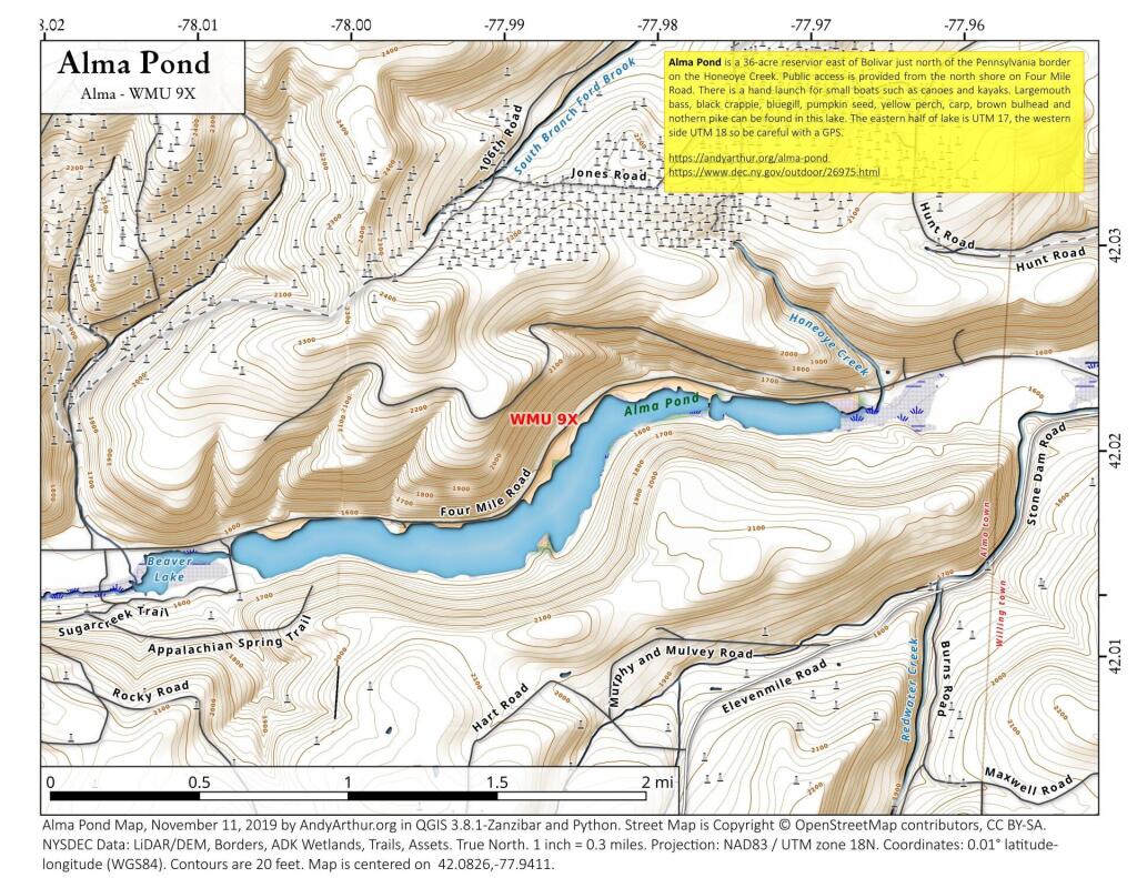
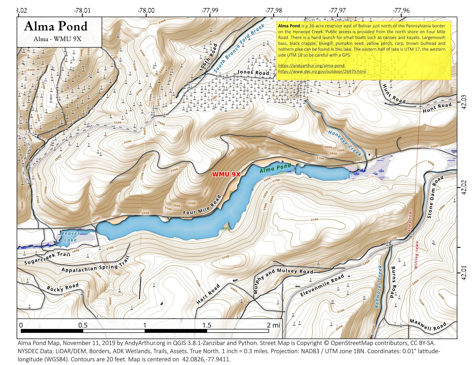
Alma Pond is a 36-acre reservior east of Bolivar just north of the Pennsylvania border on the Honeoye Creek. Public access is provided from the north shore on Four Mile Road. There is a hand launch for small boats such as canoes and kayaks. Largemouth bass, black crappie, bluegill, pumpkin seed, yellow perch, carp, brown bulhead and nothern pike can be found in this lake. The eastern half of lake is UTM 17, the western side UTM 18 so be careful with a GPS.
https://www.dec.ny.gov/outdoor/26975.html


Bookmark my free Interactive GPS Map for your phone:
https://andyarthur.org/ny
... shows your location as a blue dot in relationship to campsites, trails, state land. This online map requires cell service, won't work in remote country, so also bring a paper map.
Free Download of New & Historical USGS 1:24k Topograpic Maps
Interactive maps with backcountry and roadside camping: New York, Pennsylvania, West Virginia & Vermont. List of NYS DEC Lean-Tos and Firetowers.
Google Spreadsheet with Roadside, Primitive and Pay Campsites
More about Notes...
Download the PDF Map Pack with All Maps from Notes.


")


