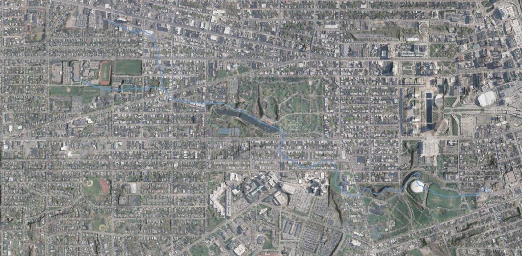
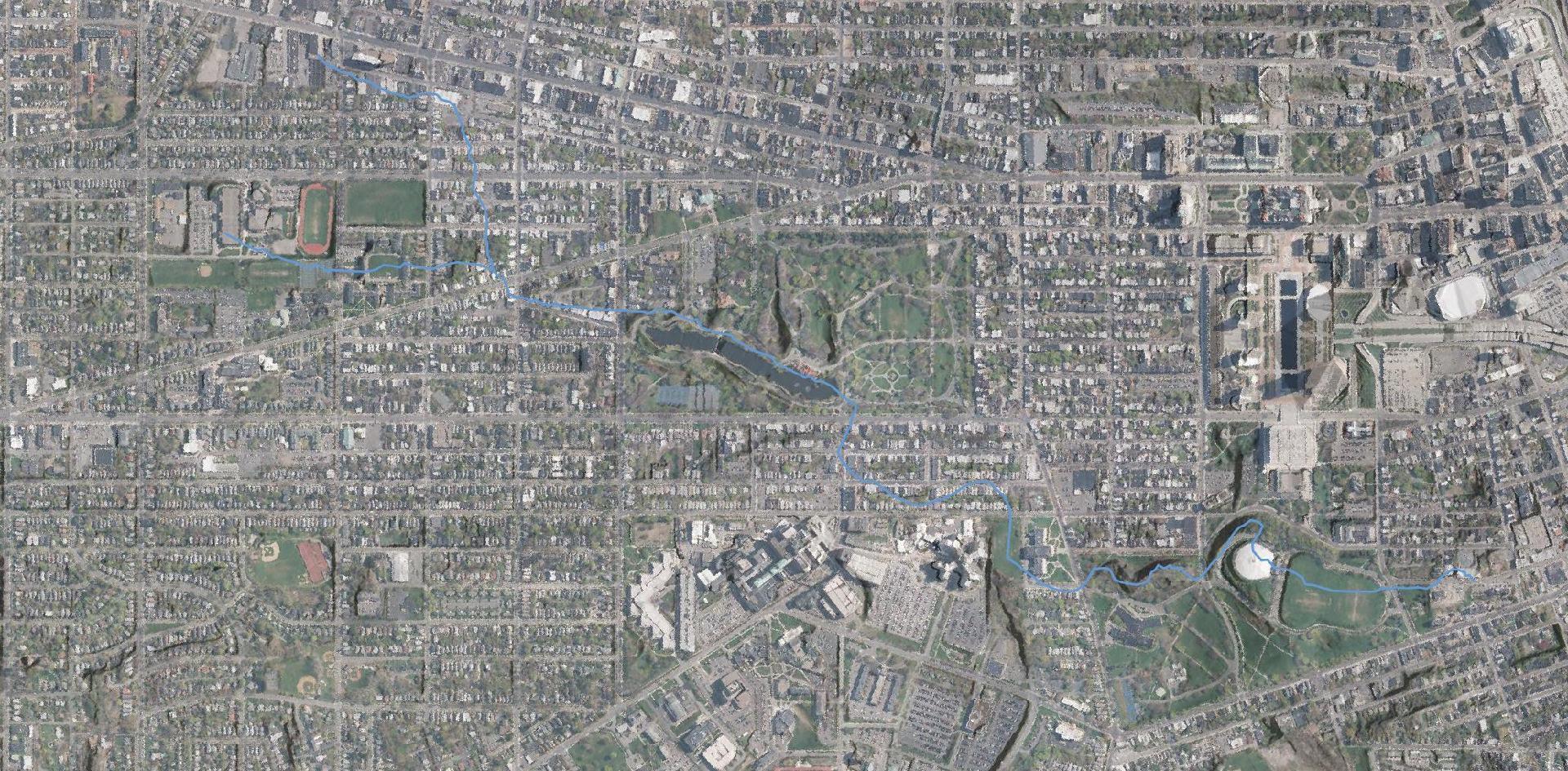
Beaver Kill in Albany  🗺️

Download a High Resolution JPEG Image of the Terrain Beaver Kill in Albany or an Adobe Acrobat Printable PDF of the Terrain Beaver Kill in Albany.

About Beaver Kill in Albany ....

Today if you went Downtown you would be hard pressed to find much of the Beaver Kill or Beaver Creek. Most of it is buried in the Big C Pipe, although they are proposing to daylight part of it in Lincoln Park during the coming years. Probably the best place to see it would be in what is now Washington Park Lake.

Data Source: 1866 Beers Map of Albany from the New York Public Library, georefrenced, traced and overlaid on a contemporary aerial photo and LIDAR hillshade.

Map: Boyce Hill State Forest

More about Albany, NY...

Albany is the capital city of the U.S. state of New York, the seat of Albany County, and the central city of New York's Capital District. Roughly 135 miles (217 km) north of the City of New York, Albany sits on the west bank of the Hudson River, about 10 miles (16 km) south of its confluence with the Mohawk River. The population of the city was 97,856 at the time of the 2010 census.

http://en.wikipedia.org/wiki/Albany,_New_York

Map: Oak Ridge Multiple Use Area
SVGZ Graphic: 2000 and 2020 Decennial Census Population
SVGZ Graphic: Albany Median Household Income by Ward
SVGZ Graphic: Areas Developed in the City of Albany, 1986-2021
SVGZ Graphic: Capital Region Population Density
SVGZ Graphic: Municipalities with a Similiar Population Density to Albany
SVGZ Graphic: Percent of Albany County Homeowners Who Moved in Before 1990
Terrain Map: Albany Plan 1695
Terrain Map: Artery Art, Albany
Terrain Map: Buildings Constructed in Capital Region, 2015-2020
Terrain Map: Clarksville 1859
Terrain Map: Proposed Downtown Retail District - Plan for the Capital City
Thematic Map: 2015-2020 New Buildings Constructed in New York State
Thematic Map: African Americans By Election District in Albany County
Thematic Map: Albany City Wards – Redistricting Winners and Losers
Thematic Map: Albany City Wards 2024
Thematic Map: Albany Zip Codes
Thematic Map: Albany's South End, Historic Dumping Grounds
Thematic Map: Bernie Sanders Plan A
Thematic Map: Bernie Sanders Plan B
Thematic Map: Court Street 1787
Thematic Map: Distance and Population to State Capitol (50 mile increments)
Thematic Map: Downtown Albany - Non-Tax Exempt Properties
Thematic Map: Drive Time to Downtown Albany
Thematic Map: Fort Orange Today
Thematic Map: Gerald Jennings 2009 Primary Campaign Contributions
Thematic Map: Median Year Building Built
Thematic Map: Thompson Lake Nature Trail LiDAR
Thematic Map: Year Building - Constructed in Albany
Photo: Bus Turns On To Eagle Street
Photo: Dogwood
Photo: Gothic
Photo: Roosevelt's Car (Rear)
Photo: Dune willow
Photo: Observation Deck
Photo: Red, Yellow, White Tulip
Photo: Low Clouds Hang Over Albany
Photo: Patroon Island Bridge
Photo: Terrace Garden

Leave a Reply

Your email address will not be published. Required fields are marked *