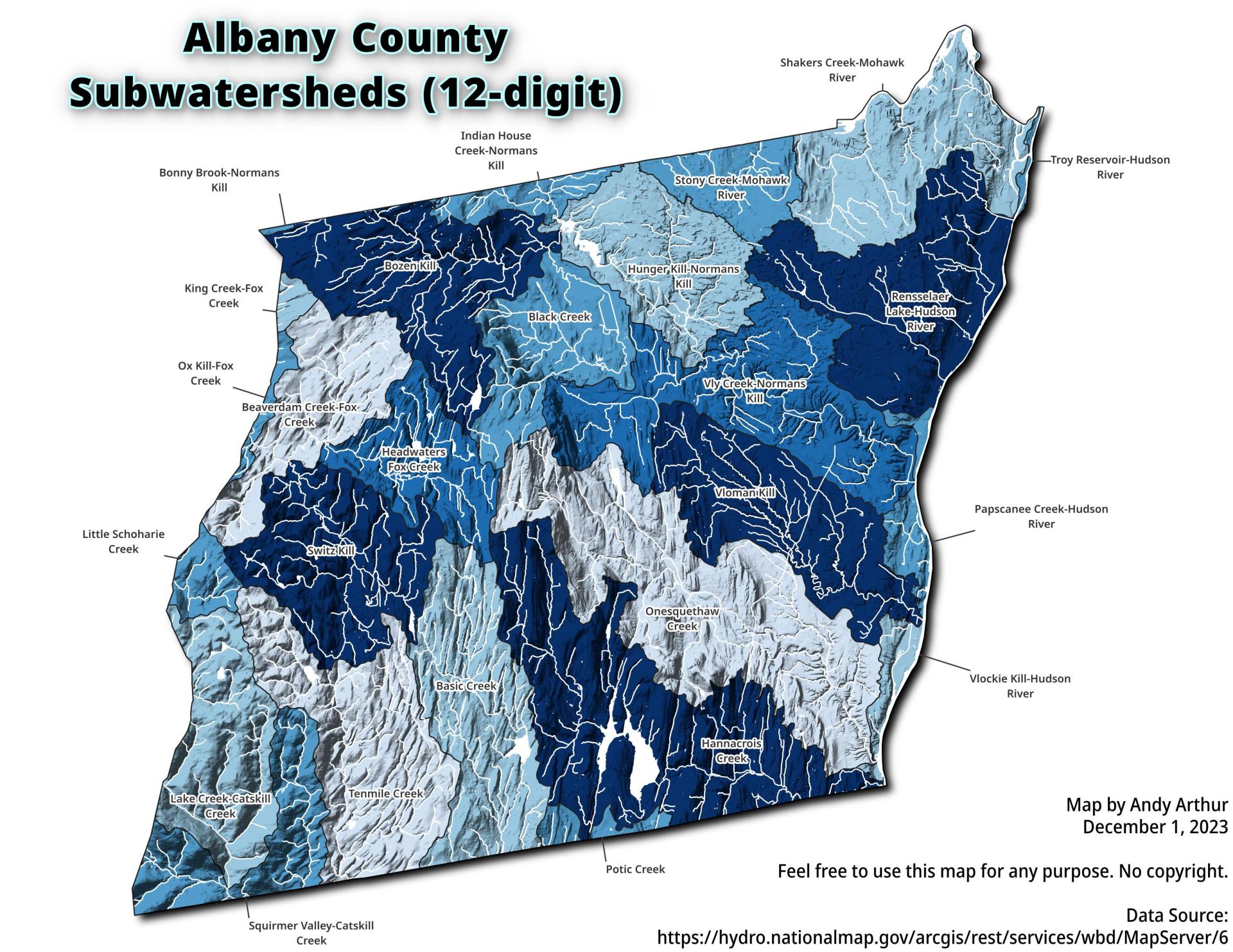
Albany County, NY Sub-watersheds 🗺️

Download a High Resolution JPEG Image of the Albany County, NY Sub-watersheds or an Adobe Acrobat Printable PDF of the Thematic Albany County, NY Sub-watersheds.
About Albany County, NY Sub-watersheds ....
A map of the sub-watersheds that make up Albany County, overlaid by hillshade and with major creeks and rivers shown.

More about Albany County...
Albany County (/ˈɔːlbəniː/ awl-bə-nee) is a county located in the U.S. state of New York, and is part of the Albany-Schenectady-Troy Metropolitan Statistical Area. The name is from the title of the Duke of York and Albany, who became James II of England (James VII of Scotland). As of the 2010 census, the population was 304,204.[1] As originally established, Albany County had an indefinite amount of land, but has only 530 square miles (1,400 km2) as of March 3, 1888. The county seat is Albany, the state capital.
http://en.wikipedia.org/wiki/Albany_County,_New_York


