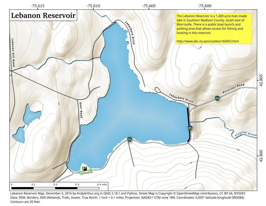
Lebanon Reservoir
Download a High Resolution JPEG Image of the Lebanon Reservoir or an Adobe Acrobat Printable PDF of the Lebanon Reservoir.


Bookmark my free Interactive GPS Map for your phone:
https://andyarthur.org/ny
... shows your location as a blue dot in relationship to campsites, trails, state land. This online map requires cell service, won't work in remote country, so also bring a paper map.
Free Download of New & Historical USGS 1:24k Topograpic Maps
Interactive maps with backcountry and roadside camping: New York, Pennsylvania, West Virginia & Vermont. List of NYS DEC Lean-Tos and Firetowers.
Google Spreadsheet with Roadside, Primitive and Pay Campsites
More about Madison County, NY...
Madison County, situated in central New York State, is home to a population of 73,442 as per the 2010 census. This county is a pivotal part of the Syracuse, NY Metropolitan Statistical Area. Positioned east of Syracuse, slightly north of Binghamton, and west of Albany, Madison County holds the honor of housing the state's geographic center in Pratts Hollow, within the Town of Eaton. With Oneida Lake and Oneida Creek framing part of its northern border and Chittenango Creek defining the western boundary, Madison County boasts picturesque landscapes.
This page focuses on free camping opportunities on state land within Madison County, extending an invitation for outdoor enthusiasts to explore the region's diverse offerings, including hiking, biking, kayaking, and various outdoor pursuits.
Download the PDF Map Pack with All Maps from Madison County, NY.


