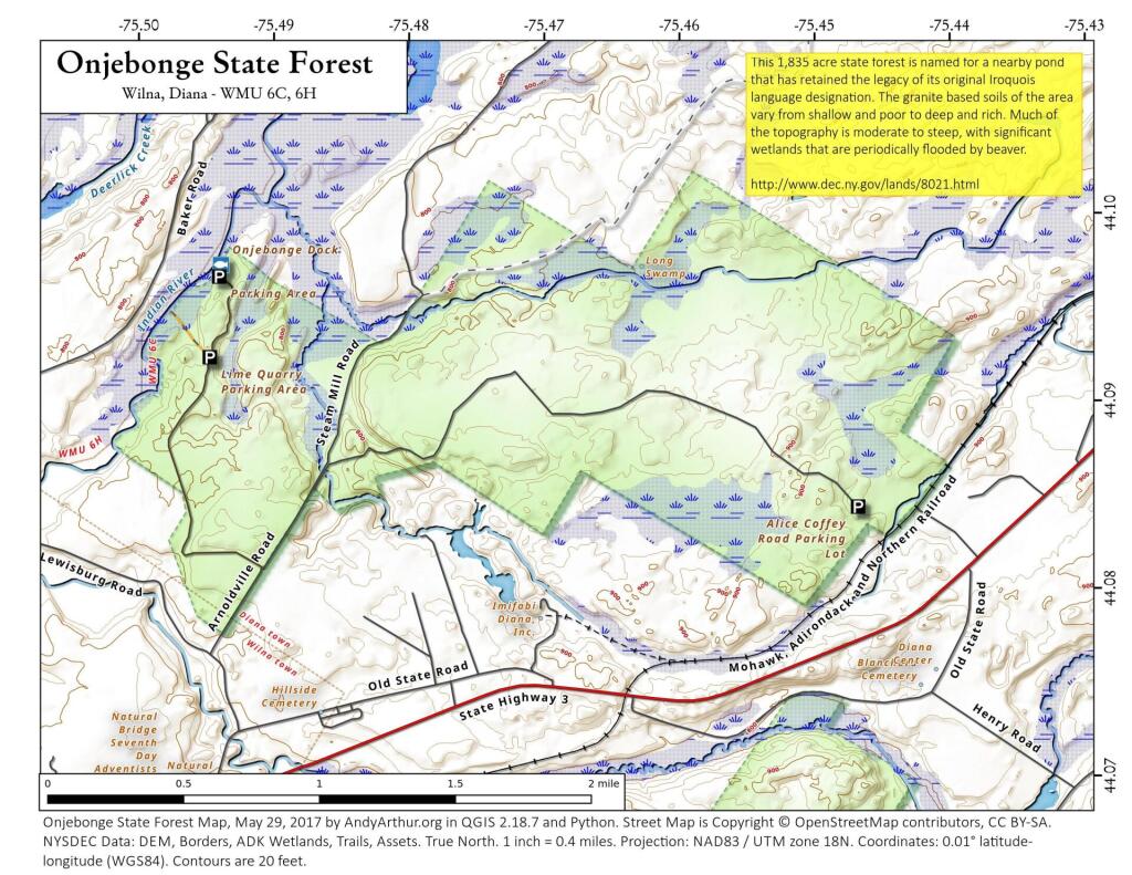
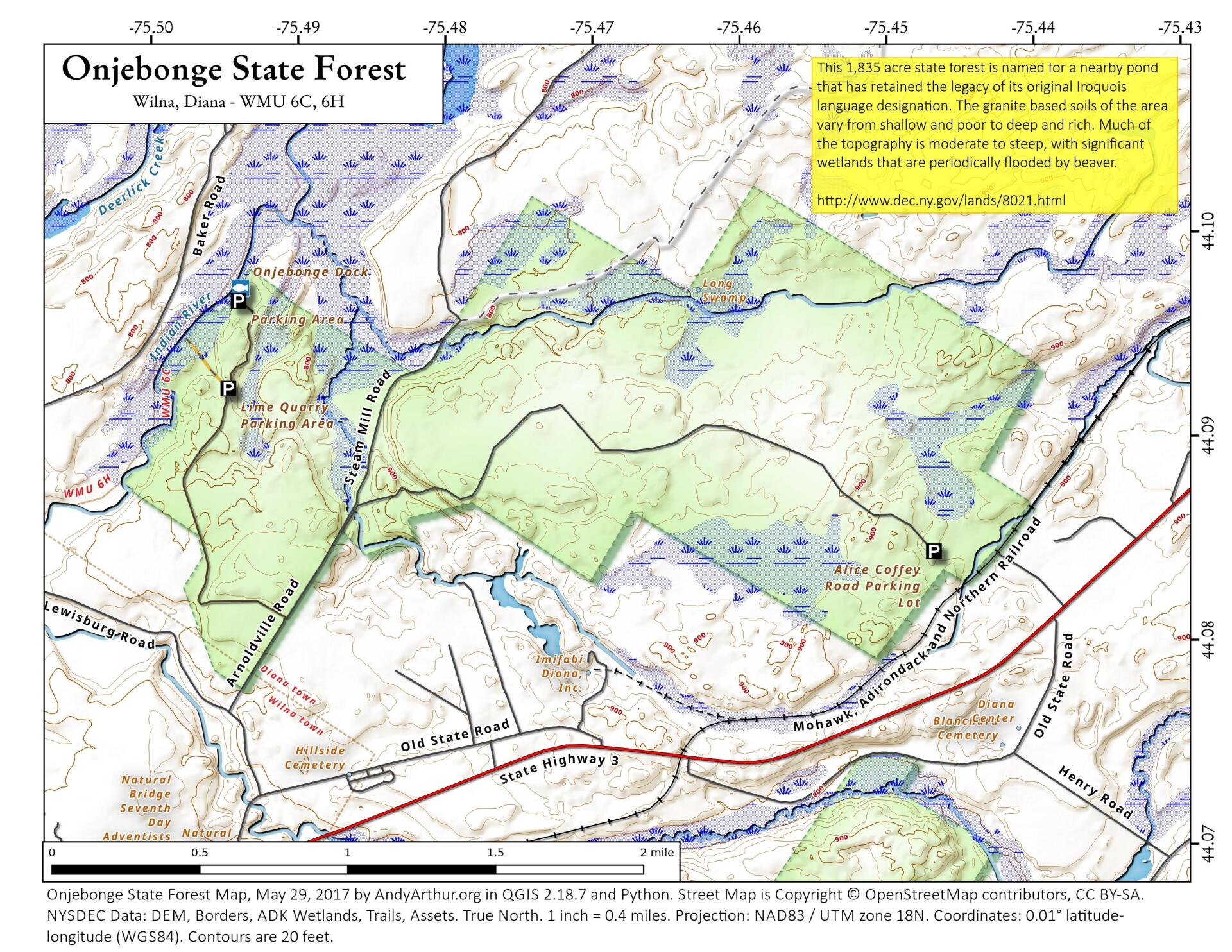
Onjebonge State Forest
Download a High Resolution JPEG Image of the Onjebonge State Forest or an Adobe Acrobat Printable PDF of the Onjebonge State Forest.


Bookmark my free Interactive GPS Map for your phone:
https://andyarthur.org/ny
... shows your location as a blue dot in relationship to campsites, trails, state land. This online map requires cell service, won't work in remote country, so also bring a paper map.
Free Download of New & Historical USGS 1:24k Topograpic Maps
Interactive maps with backcountry and roadside camping: New York, Pennsylvania, West Virginia & Vermont. List of NYS DEC Lean-Tos and Firetowers.
Google Spreadsheet with Roadside, Primitive and Pay Campsites
More about St. Lawrence County...
St. Lawrence County is a county located in the U.S. state of New York. As of the 2010 census, the population was 111,944.[1] The county seat is Canton.
Saint Lawrence County is home to St. Lawrence University, State University of New York at Potsdam, Clarkson University, the SUNY-ESF Ranger School, and the State University of New York at Canton. Part of the County is in the Adirondack Park and includes much of the Oswegatchie River, Cranberry Lake and Lake Ozonia.
http://en.wikipedia.org/wiki/St._Lawrence_County,_New_York
Download the PDF Map Pack with All Maps from St. Lawrence County.


