Breadboard vs Perfboard  🖼️

Download a High Resolution JPEG Image of the Breadboard vs Perfboard or an Adobe Acrobat Printable PDF of the Breadboard vs Perfboard.

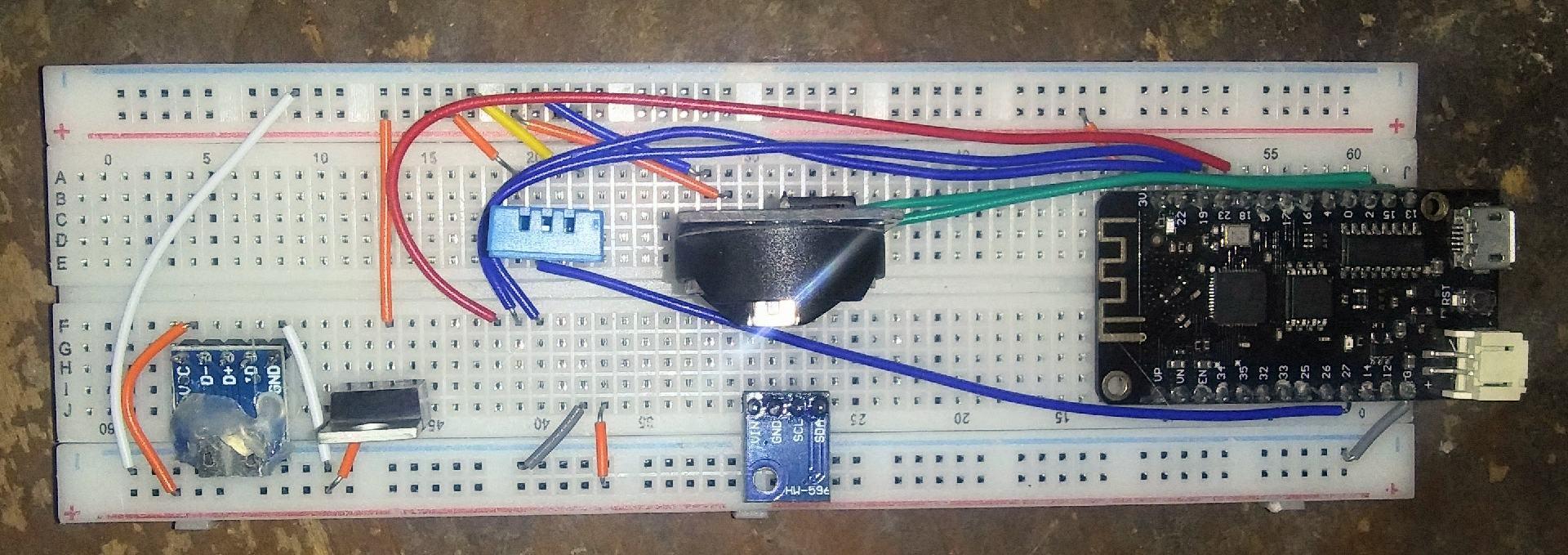
Breadboard vs Perfboard ...

I used to build all my finalized projects with old fashioned perf board, solder and jumper wires. But solder is kind of a pain - it's much too easy to accidentally bridge the pins and sometimes it grows whiskers - and when you add components or sensors or make wiring mistakes - you end up doing a lot of soldering and desoldering. Bad solder joints can lead to endless frustration when you have noise in the signals. 

Breadboard like this is inexpensive when buy direct from China, plus is so much more flexible and actually is pretty reliable and long lasting once the wires are seated. Changes are super easy - just unplug the wires, no desoldering required. 

And it seems like with the latest in low cost microcontrollers (costing less than $5) - fewer external sensors are needed as more things are on board. For many projects I a just a handful of sensors and things like power transistors or relays and power supply is all that has to be done off board. 

Taken on Sunday December 6, 2020 at Albany, NY.

Map: Granger State Forest

More about Albany, NY...

Albany is the capital city of the U.S. state of New York, the seat of Albany County, and the central city of New York's Capital District. Roughly 135 miles (217 km) north of the City of New York, Albany sits on the west bank of the Hudson River, about 10 miles (16 km) south of its confluence with the Mohawk River. The population of the city was 97,856 at the time of the 2010 census.

http://en.wikipedia.org/wiki/Albany,_New_York

Map: Oak Ridge Multiple Use Area
SVGZ Graphic: 2000 and 2020 Decennial Census Population
SVGZ Graphic: Albany Median Household Income by Ward
SVGZ Graphic: Areas Developed in the City of Albany, 1986-2021
SVGZ Graphic: Capital Region Population Density
SVGZ Graphic: Municipalities with a Similiar Population Density to Albany
SVGZ Graphic: Percent of Albany County Homeowners Who Moved in Before 1990
Terrain Map: Albany Plan 1695
Terrain Map: Artery Art, Albany
Terrain Map: Beaver Kill in Albany
Terrain Map: Buildings Constructed in Capital Region, 2015-2020
Terrain Map: Clarksville 1859
Terrain Map: Proposed Downtown Retail District - Plan for the Capital City
Thematic Map: 2015-2020 New Buildings Constructed in New York State
Thematic Map: African Americans By Election District in Albany County
Thematic Map: Albany City Wards – Redistricting Winners and Losers
Thematic Map: Albany City Wards 2024
Thematic Map: Albany Zip Codes
Thematic Map: Albany's South End, Historic Dumping Grounds
Thematic Map: Bernie Sanders Plan A
Thematic Map: Bernie Sanders Plan B
Thematic Map: Court Street 1787
Thematic Map: Distance and Population to State Capitol (50 mile increments)
Thematic Map: Downtown Albany - Non-Tax Exempt Properties
Thematic Map: Drive Time to Downtown Albany
Thematic Map: Fort Orange Today
Thematic Map: Gerald Jennings 2009 Primary Campaign Contributions
Thematic Map: Median Year Building Built
Thematic Map: Thompson Lake Nature Trail LiDAR
Thematic Map: Year Building - Constructed in Albany
Photo: Looking Up the State Street Hill
Photo: At the Rally
Photo: Buildings in South End
Photo: Camp
Photo: Spring Morning
Photo: Reflections
Photo: 90 State Reflects on 80 State
Photo: Patroon Island Bridge
Photo: Corning Preserve
Photo: Frame 52

Leave a Reply

Your email address will not be published. Required fields are marked *