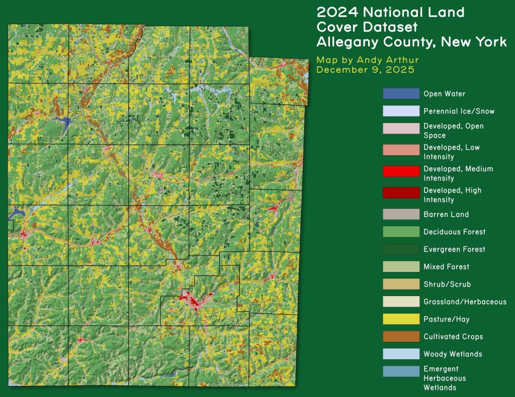
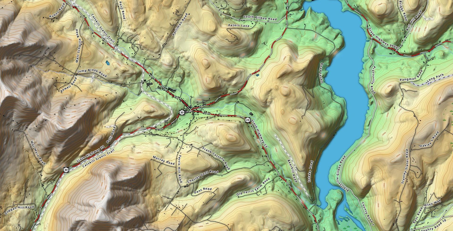
Terrain Map: Grand Gorge Download a High Resolution JPEG Image of the Terrain Grand Gorge or an Adobe Acrobat Printable PDF of the Terrain Grand Gorge. About Grand Gorge .... More about Schoharie County...Schoharie County is a county located in the U.S. state of New York. As of the 2010 census, the population was 32,749. The county seat is Schoharie. A primarily rural county known for the fertile Schoharie Valley, it is also home to many state forests, including Burnt-Rossman State Forest. http://en.wikipedia.org/wiki/Schoharie_County,_New_York Aerial PhotosEsperanceLost ValleyMiddleburghSchoharie ValleyMaps and InteractivesWest Fulton, NYWest ConesvilleWalmart Distribution Center in Sharon SpringsTerrance MountainScott Patent HillSchoharie Valley Topographic MapSchoharie County Land UseRundy Cup MountainRoughly half of Middleburgh is in the flood plainPine Mountain – West RichmondvilleNYPA Gilboa Pump Storage FacilityNational Land Cover Dataset – Schoharie ValleyMount PisaghMine Kill PoolMiddleburgh CliffMiddleburgh 1995-2022 through the YearsMiddleburg 1898Homes Built Before the Civil War in MiddleburghGilboa DamGas Up Grounds Off SeasonFranklinton Vlaie – September 2022Franklinton VlaieFort HunterDuck Pond... photos, maps and other content from from Schoharie County. Leave a Reply Cancel replyYour email address will not be published. Required fields are marked *Comment * Name * Email * Website Save my name, email, and website in this browser for the next time I comment. Δ
More about Schoharie County...Schoharie County is a county located in the U.S. state of New York. As of the 2010 census, the population was 32,749. The county seat is Schoharie. A primarily rural county known for the fertile Schoharie Valley, it is also home to many state forests, including Burnt-Rossman State Forest. http://en.wikipedia.org/wiki/Schoharie_County,_New_York Aerial PhotosEsperanceLost ValleyMiddleburghSchoharie ValleyMaps and InteractivesWest Fulton, NYWest ConesvilleWalmart Distribution Center in Sharon SpringsTerrance MountainScott Patent HillSchoharie Valley Topographic MapSchoharie County Land UseRundy Cup MountainRoughly half of Middleburgh is in the flood plainPine Mountain – West RichmondvilleNYPA Gilboa Pump Storage FacilityNational Land Cover Dataset – Schoharie ValleyMount PisaghMine Kill PoolMiddleburgh CliffMiddleburgh 1995-2022 through the YearsMiddleburg 1898Homes Built Before the Civil War in MiddleburghGilboa DamGas Up Grounds Off SeasonFranklinton Vlaie – September 2022Franklinton VlaieFort HunterDuck Pond... photos, maps and other content from from Schoharie County.
Leave a Reply Cancel replyYour email address will not be published. Required fields are marked *Comment * Name * Email * Website Save my name, email, and website in this browser for the next time I comment. Δ
