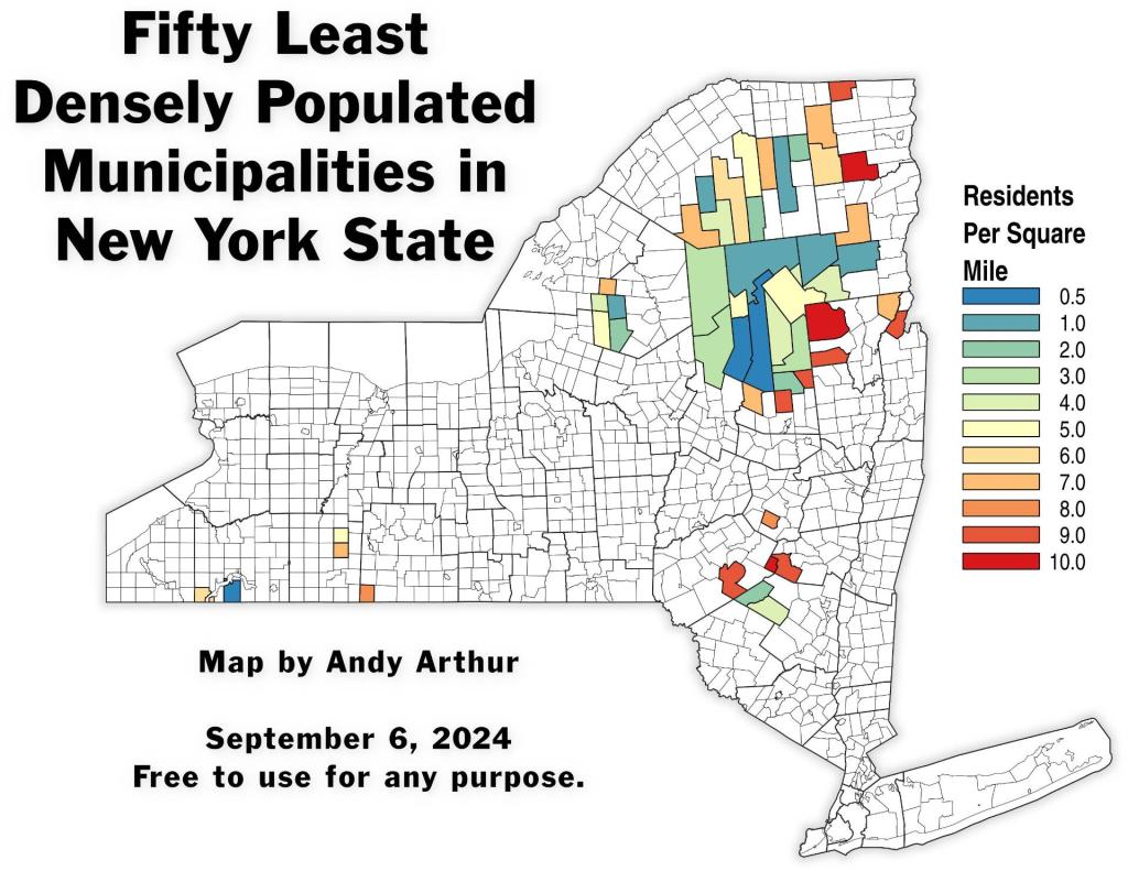
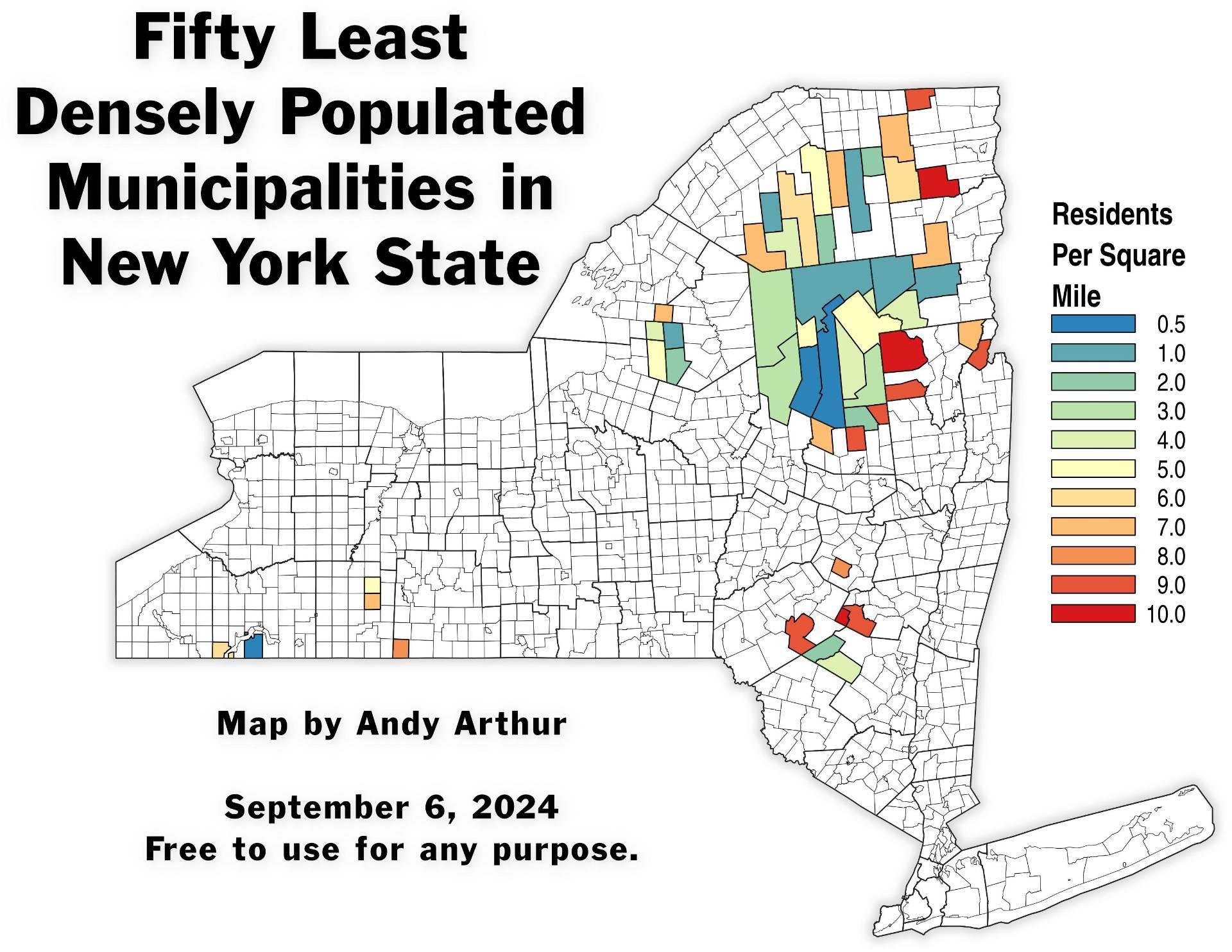
Thematic Map: Fifty Least Densely Populated Municipalities in NY State Download a High Resolution JPEG Image of the Fifty Least Densely Populated Municipalities in NY State or an Adobe Acrobat Printable PDF of the Thematic Fifty Least Densely Populated Municipalities in NY State. More about NYS Census...New York State mapped and discussed, using Census data. Lots of interesting infographics can be found here. Maps and InteractivesWalking Distance from HomePopulation Density of New York StateNY School District Population DensityNew York State County Population DensityMost Common Heating Fuel in New York StateLarge Urban Counties are gaining population in New York StateFifty Least Densely Populated Municipalities in NY StateEach Dot Represents 1,000 New YorkersAn Irish Conundrum9 Out of Ten New Yorkers Live Here5 Percent2023 Births Per 1,000 Women Aged 15-44NYS Median Household Income by MunicipalityNew York Counties Ranked from Poorest to WealthiestHigh School Drop Outs Map... photos, maps and other content from from NYS Census. Leave a Reply Cancel replyYour email address will not be published. Required fields are marked *Comment * Name * Email * Website Save my name, email, and website in this browser for the next time I comment. Δ
More about NYS Census...New York State mapped and discussed, using Census data. Lots of interesting infographics can be found here. Maps and InteractivesWalking Distance from HomePopulation Density of New York StateNY School District Population DensityNew York State County Population DensityMost Common Heating Fuel in New York StateLarge Urban Counties are gaining population in New York StateFifty Least Densely Populated Municipalities in NY StateEach Dot Represents 1,000 New YorkersAn Irish Conundrum9 Out of Ten New Yorkers Live Here5 Percent2023 Births Per 1,000 Women Aged 15-44NYS Median Household Income by MunicipalityNew York Counties Ranked from Poorest to WealthiestHigh School Drop Outs Map... photos, maps and other content from from NYS Census.
Leave a Reply Cancel replyYour email address will not be published. Required fields are marked *Comment * Name * Email * Website Save my name, email, and website in this browser for the next time I comment. Δ